
Earlier this week, the Nicomekl River spilled its banks into the floodplain and beyond. I posted in September about the river measurement station near the 203rd Street Bridge. This morning, I looked at the historical flows since Environment Canada put the measurement station into service in 1985.

Previous to this week, the maximum flow was 61.6 m3/sec in 2009. On Monday, November 15th, the flow was 76.9 m3/sec.

|
| Annual Daily Extremes - Flow, Nicomekl River at 203rd Street. Select graph to enlarge. Source: Environment Canada |
Environment Canada started taking level measurements in 2011.
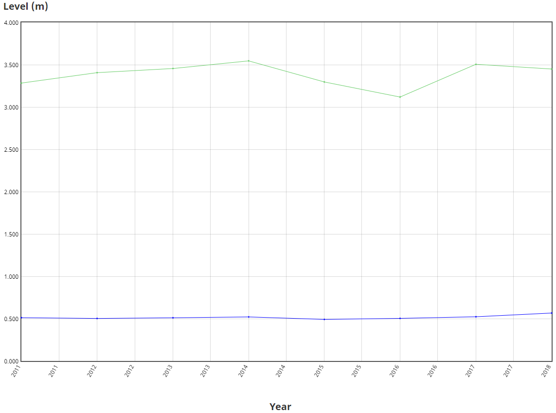
|
| Annual Daily Extremes - Level, Nicomekl River at 203rd Street. Select graph to enlarge. Source: Environment Canada |
The river was at a peak height of 4.63m on Monday.

|
| Realtime Flow and Level Data, Nicomekl River at 203rd Street. Select graph to enlarge. Source: Environment Canada |
All that to say, Langley City experienced the highest level of the Nicomekl River and most localized flooding in my lifetime.
No comments:
Post a Comment