Thursday, January 31, 2019

New education program about overdose crisis launched for Langley businesses

Fentanyl has entered the drug supply. This has resulted in an epidemic of overdoses and deaths in communities throughout BC. Langley is no exception. 70% of overdoses occur in private residences, and primarily impact younger men. People who are at risk of a fatal overdose could be a co-worker or friend.

The Stepping Stone Community Services Society has been operating in Langley since 1984. They provide services for people living with mental illness, affordable housing options for people, and operate a Homelessness Outreach Program.

Stepping Stone has recently launched a new education program for businesses. If you are a business owner or manager, the following information is for you. The following is from Stepping Stone:

The Langley Community Overdose Response Committee has received a grant to provide education to businesses as a response to the current overdose crisis in Langley.

We have named this project “We all play a ROLE”. Our R.O.L.E. is Responding to Overdose in Langley through Education.

At no cost to you, we would like to offer a catered meal (lunch or snack) while we share an informative and engaging presentation.

Our primary goal is to educate employers and their employees about the ongoing overdose crisis and how a toxic drug supply in BC has increased the risk of overdose.

Individuals within your business may be directly or indirectly impacted by the overdose crisis. Our aim is to be sensitive of your employees’ privacy, as we realize this topic within the workplace can be complex.

You may feel the risk of overdose is not a relevant issue for your business. However, we propose that learning about this crisis, informing your employees, being open to understanding substance use and being prepared to respond to overdoses is immensely valuable to all.

The stigma around mental illness has been consistently improving in our society because of well- prepared and targeted campaigns designed to help people understand that it is not something to be hidden. In the same way, we feel that substance use and its inherent risks should be discussed openly so that stigma can be reduced, and the risk of overdose mitigated.

What can you expect from us?

  • A catered lunch or snack, whatever works best for your business and schedule
  • An engaging presentation designed to fit your business needs. Topics of discussion include:
    • Statistics and background on the overdose crisis and how they relate to all of us
    • Learn about the impact of the crisis on Langley City and Township
    • Stigma awareness and our attitudes towards drugs, addiction and overdose
    • General information on the toxicity of the drug supply in British Columbia
    • Understand who is at risk
    • Recognizing an overdose, know the signs, and how to respond to an overdose
    • Interactive Q&A and information about resources within your community

If you would like to book an education session, please contact Arianna (604)-837-6778 or Daniel (604)-309-2777

Wednesday, January 30, 2019

Some facts about UBC SkyTrain

Extending the SkyTrain to UBC has become a hot topic recently with a renewed push by both the mayor of the City of Vancouver and UBC to extend the line. Currently, work is underway to extended the Millennium Line to Arbutus in Vancouver.

Map of proposed UBC SkyTrain Extension Stations. Select map to enlarge.

There were several options on the table that were being evaluated for the eventual connection of rail rapid transit to UBC from Arbutus.There were two surface light rail options, and a SkyTrain option. Last week, an updated technical report was released about the potential rail rapid transit options. The following table outlines the updated information about the options.

Comparison table of B-Line, Light Rail, and SkyTrain (RRT). Select table to enlarge.

What becomes clear pretty fast is that while SkyTrain costs about double the price of light rail, it would provide the best long-term value for transit service to the UBC campus.

SkyTrain would cost about $3.8 billion to build, though if some sections where built at ground level in the less urban area, the cost could be reduced to $3.5 billion.

While light rail would have more capacity than the current B-Line service, it would have very similar travel times. This is because it would be running at ground level, and would have to cross many intersections. SkyTrain would cut travel times in half for transit riders. The updated report also noted that light rail would be at capacity by 2045 while SkyTrain would still have room to grow.

The following table shows the predicted peak westbound morning volume for the potential UBC SkyTrain extension in 2045. The red line represents the maximum SkyTrain capacity.

Westbond AM peak SkyTrain demand in 2045. Select chart to enlarge.

What stands out to me is the extremely low volume of passengers that would use the proposed Alma and Sasamat stations. I would hope that if a $3.8 billion SkyTrain extension is approved, the City of Vancouver would work hard to increase the housing options in those station areas.

The final table shows how the report authors calculated the cost of building the UBC SkyTrain extension.

SkyTrain Element Calculation Methodology Unit Cost
At-Grade $70m per km * 1.15 $80m per km
Elevated $70m per km * 2 $140m per km
Elevated Station $50m
Tunnel $160m per km
Tunnel Station $100m

Building SkyTrain to UBC is needed, but the challenge will be to come up with the funding. While UBC has committed to funding a portion of the project costs, the federal and provincial governments will also have to come to the table with significant financial commitments.

One of the concerns that I have is that SkyTrain to UBC would push back building SkyTrain to Langley. The good news is that the dollars that the federal and provincial governments have currently committed to building rail transit in the South of Fraser can’t simply be reallocated to build SkyTrain to UBC.

There is still a regional funding gap that needs to be plugged before SkyTrain can be built to Langley. The Mayors’ Council will have their work cut out for them to plug the gap to fund both proposed SkyTrain extensions in addition to other regional transit projects.

Tuesday, January 29, 2019

January 28, 2019 Council Meeting Notes: McBurney Plaza Summer Series Back and Task Groups Approved

Last night was a lighter Langley City council agenda, but there were some significant items that moved forward.

The meeting started with Councillor Teri James, who is also the Executive Director of the Downtown Langley Business Association, presenting on the upcoming 2019 McBurney Plaza Summer Series. This summer events series is now entering its fifth year and is still going strong.

This year, the McBurney Plaza Summer Series will have three daytime events which will run with extended hours from 11am to 3pm. Besides the event programming, there will also be freebie bags. The three daytime events include Backyard Party in the Plaza which will include fun activities, BBQ sliders, and shaved ice.

Legends in the Plaza will feature tribute acts for such stars as Tina Turner, Michael Jackson, and Elvis. Magic in the Plaza will include street magic and illusionist. Mark you calendar for June 22, July 20, and August 11.

Also back by popular demand is the 19+ Dueling Pianos event which will run from 6pm to 10pm on July 13th. This is a Vegas-style show. There will be food, craft beer, and local wine. I attended this event two years ago, and it was a lot of fun. Tickets will be $15, and I know I’ll be getting mine as soon as they become available.

With more event coming to our community, I look forward to when every weekend there is an event or activity happening in our downtown core.

Council also approved the creation of three task groups, two new and one returning:

  • Performing Arts and Cultural Centre Task Group
  • Economic Development Task Group
  • 2019 Crime Prevention Task Group

The Performing Arts and Cultural Centre Task Group mandate will be to continue the process that will hopefully result in a performing arts centre being built in Downtown Langley. Its mandate will include:

  • Developing a 5 – 10 year detailed provisional business plan and a 25-year high level provisional business plan.
  • Developing a fund-raising campaign plan, including identify potential partner prospects.
  • Defining a governance model for the operation of the centre.
  • Engaging First Nations partnership.

The Economic Development Task Group general mandate will be to plan for the arrival of SkyTrain in our community in a way that will maximize its economic potential for Langley City. The task group will be putting forward initiatives for council to consider to make sure that Langley City is open for business, including the new opportunities that rail rapid transit will bring.

The 2019 Crime Prevention Task Group, which I am chairing, will be continuing some of the successful programs such as the “Know Your Neighbour” campaign. Other items in the mandate include:

  • Working with the Youth Committee and the RCMP around crime reduction strategies for youth-specific issues.
  • Partnering with the RCMP, Community Police Office, Downtown Langley Business Association, and Chamber of Commerce to increase participation in crime prevention programs.
  • Partnering with the Langley Seniors Resource Centre to create strategies to educate the public on how to address senior-related issues such as elder abuse.

Task groups are an important way to get thing done, and our new council is hitting the ground running.

Monday, January 28, 2019

Vancouver-Seattle rail service stats, bullet trains, and a more pragmatic approach to providing better service.

During the summer, I posted information about the latest study into the feasibility of building high-speed rail between Vancouver, Seattle, and Portland.

Unlike other studies, this $1.5 million study is funded by Washington State, the Province of BC, Oregon, and Microsoft.

The estimated cost of the line would be in the $40 billion range; $40 billion would build SkyTrain everywhere in Metro Vancouver.

Recently, I had the chance to ride the Amtrak Cascades rail service which runs from Vancouver to Seattle, and it got me curious about the current ridership on the corridor.

10-Year Ridership by Funding Partners, 2008-2017. Select chart to enlarge.

Ridership along the corridor for the most part has been increasing steadily. It peaked in 2011, then declined with the low occurring in 2015. Since then, ridership had been on the rise again. Ridership was 811,000 in 2017, which was slightly lower than in 2016. There was a serious derailment in 2017 which had an impact on ridership.

While not an apples to apples comparison, West Coast Express ridership was 2,323,000 in 2017 with five trains a day.

Since 2010, Washington State has invested close to $800 million to improve the on-time performance, frequency, and speed in Amtrak Cascades service. One of the biggest changes to improve performance of the service will be when the Port Defiance bypass reopens later this year. The bypass will speed up service, and allow six round-trip trains per day to travel between Portland and Seattle.

Seattle, Portland, and Vancouver, BC are the highest ridership stations along the corridor. In fact, travel between Vancouver and Seattle is responsible for 19% of the revenue which is behind travel between Seattle and Portland which accounts for 31% of revenue. This is impressive considering that there are double the trains between Seattle and Portland.

Annual Ridership by Segment in 2017. Select chart to enlarge.

There are some limitations to increasing rail service in Canada. One is the cost of providing border services, and the other is the rail corridor in Canada. For example, rail service has to use the over 100 year old Fraser River Rail bridge which is congested. It also has to travel slowly through White Rock beach.

While the provincial government and Washington State are studying bullet trains, a more pragmatic approach might be to invest in a few key upgrades such as bypassing White Rock and budgeting for more border services. This would allow more trains between our countries, and would make train service faster than driving. This would be more feasible than a $40 billion bullet train.

Thursday, January 24, 2019

Protecting Sensitive Ecosystems in Metro Vancouver

Metro Vancouver is a region in constant tension, and nowhere is this more evident than in how we use or preserve the land. Our region is home to more than half of the population of British Columbia. We are also home to the most productive farmland in the province. Metro Vancouver has some of the most sensitive habits from migratory birds, fish, and plant life in the country.

The Metro Vancouver Regional District controls a significant portion of land in our region. Of the land that the regional district controls, 5% is protected as parks and 17% is protected for our watershed. The following chart shows that around 40% of the land in our region is protected from development.

Percentage of protected areas in Metro Vancouver. Source: Metro Vancouver.

The following map from Metro Vancouver shows what land is considered sensitive ecosystems which is not protected (red) and what areas are currently protected (green). The unprotected areas represent about 10% of the land in our region.

Map of sensitive ecosystems in Metro Vancouver. Source: Metro Vancouver.

One of the regional district’s goals is to acquire property for conservation purposes. The following map shows areas that provide the highest conservation potential in our region (yellow).

Map of areas with high regional conservation potential. Select map to enlarge. Source: Metro Vancouver.

There is significant opportunity in the South of Fraser to protect more land, thought the regional districts ability to purchase this land is limited due to the cost of land. As time goes on, the ability to purchase these properties diminishes. Metro Vancouver has shown leadership in the past such as with the protection of Burns Bog. I’m hopefully that this legacy of purchasing and protecting land continues.

Wednesday, January 23, 2019

Review of the Massey Bridge project suggests tunnel as solution

George Massey Tunnel

In 2015, I posted about the Massey Tunnel and how back in 1955 they decided to build a tunnel and not a bridge due to cost and technical challenges. I posted a year later that building a proposed tolled bridge would have actually ended up increasing congestion on the Alex Fraser Bridge. I questioned if building a bridge was a good solution to the challenge of crossing the Fraser River along Highway 99.

One of the first things that the current NDP government did when they came to power was put a pause on the Massey Tunnel replacement project, and initiated an independent technical review. This independent review was released late last year.

The independent review found that the “province should re-examine the project needs and functional criteria”. One of the items that the independent review brought to light is that a new tunnel crossing to supplement the existing tunnel would be “feasible and may result increased benefits and cost savings in comparison to a new bridge.”

It seems like the original reason for building a tunnel, the cost, is just as valid today as it was in 1955.

One of the original justifications for building a bridge was that the current tunnel was “end-of-life” due to it not being able to meet modern seismic standards. The independent review found that “retrofitting the tunnel is feasible and likely cost competitive with a bridge.”

The review did note that there was an obvious need to increase the capacity in the non-peak direction as it is currently one lane, but found increasing the capacity from the current 4 to 10 lanes as proposed with the bridge project was not required. The wider a crossing is, the more expensive it is to build.

Overall, the review found that a new comprehensive feasibility study needs to be completed that would consider other options for a new or renewed Fraser River crossing for Highway 99.

The Mayors’ Council will be meeting tomorrow, and they will be receiving a report on the Massey Tunnel replacement project. TransLink is in the processing of examining the independent review and will be reporting back to the Mayors’ Council about its recommendations at a future meeting. TransLink’s review will look at the use of demand management measures such as tolling, transit, active transportation, goods movement, and people movement.

There is a clear need to upgrade the river crossing for Highway 99, though a $3.5+ billion bridge is likely not the best solution. It seems like a combination of upgrading the current Massey Tunnel and adding a second tunnel might be a better option when all is considered. It will be interesting to see what the province’s next steps will be.

Tuesday, January 22, 2019

Funding the final phase of the 10-Year Transit Vision. Funding Langley and UBC SkyTrain.

The TransLink Mayors’ Council on Regional Transportation will be meeting this Thursday. One of the items on the agenda will be extending SkyTrain to UBC.

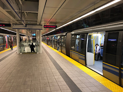
SkyTrain at Main Street Station

Today, we are in phase two of the three phase 10-Year Vision which includes expanding transit in Metro Vancouver. From a rail rapid transit perspective, this means that funding is available to build a SkyTrain extension from Commercial-Broadway Station to Arbutus Street along Broadway in Vancouver. This also means that there is funding available to build SkyTrain to somewhere in Fleetwood, since the Guildford/Whalley/Newton light rail project has been cancelled.

The final phase of the current 10-Year Vision calls for rail rapid transit service to extend along Fraser Highway to Langley City. The original plan was for light rail, but the current plan is now SkyTrain.

One of the things about the current 10-Year Vision is that the proposed projects benefit the whole region. With the shift from light rail to SkyTrain, the total funding that is allocated to the South of Fraser remains constant as the kilometres of rail rapid transit being built is being reduced from around 27 kilometers to 16.5 kilometers. Currently, there is no additional funding being requested for the South of Fraser.

There is still the outstanding matter of funding the final phase of the Vision. The current phase three funding gap would require around $120 million per year (2015 $) in new capital and operating revenue.

Incremental revenue required for projects in Regional Transportation Investments: A Vision for Metro Vancouver. Select chart to enlarge.

One of the original plans of the Mayors’ Council was to introduce new forms of mobility pricing such as distance-based tolling. This is a long-term plan, and my feeling is that there is a strong desire to get transit expanded as soon as possible. To plug the final phase funding gap, there are really three revenue sources that can be adjusted: property tax, gas tax, and the development cost charge.

Property tax and the development cost charge are likely the fairest ways to collect revenue for the 10-Year Vision as land value normally increases around high-quality transportation options. Areas that get the most benefit from the Vision will pay their fair share.

The development cost charge (DCC) in 2021 will be $1,545 per new unit of apartment, $2,470 per new unit of townhouse, and $2,975 per new single-family house. DCCs are also applied to other property types. This brings in about $29 million per year.

Increasing TransLink property tax revenue by $10 million per year impacts the average household about $5.50. The provincial government allowed the gas tax to be increased by $1.5 cents which will generate around $30 million per year.

The federal government and provincial government have also committed to funding around half of the total lifecycle cost of the 10-Year Vision. Increased revenue from transit ridership will also help plug the current funding gap.

I can image there will be lots of discussion at the Mayors’ Council table to find the combination of taxation increases that can be supported, and to re-confirm the support of the federal and provincial governments.

Building SkyTrain from Arbutus to UBC will cost between $3.3 billion and $3.8 billion (2018 $), and is not in the current 10-Year Vision.

The Mayor of Vancouver has been supportive of getting SkyTrain built in Surrey. It will be interesting to see if the Mayor of Surrey is supportive of getting SkyTrain built to UBC. Even more interesting will be to see if there is a push to build SkyTrain to UBC as part of the final phase of the 10-year Vision. If so, it will have a major impact on the funding required, and will also need increased funding commitments from both the federal and provincial governments. It is a federal election year, so anything is possible.

I’m hopefully that the region’s mayors will be able to come together to fund a transportation vision that will benefit the whole region. The need for improving transit is only growing.

Monday, January 21, 2019

Social 'Meet & Greet' for Langley LGBTQ2S Seniors and Allies

Humans are social by nature. There is strong evidence that people with many social connections to family and/or friends live happier, healthier, and longer lives. As we age, a variety of factors can lead to the number of social connections diminishing. For people who are part of a minority population, who may already have limited social connections, social isolation can be more pronounced. This has a direct impact on quality of life.

Last year, I posted about a LGBTQ2 seniors’ social that took place at Timms Community Centre. This year, QMUNITY, a non-profit that works to improve queer, trans, and Two-Spirit lives, in partnership with the Langley Seniors Resource Society is hosting two events this Thursday.

The first event is a workshop geared towards people and organizations that provide services to older adults called, “Are you interested in building safe, inclusive environments for your organization’s Older Adult & Senior LGBTQ2S+ members?”

Date: Thursday, January 24
Time: 9:00am-1:00pm
Location: Langley Senior Resources Society
20605-51B Avenue

REGISTRATION: qctLangley.eventbrite.ca

The second event is a seniors social meet & greet with QMUNITY where they will “introduce ourselves and meet other local community members seeking connection.”

Poster for Social Meet & Greet with QMUNITY. Select poster to enlarge.

Date: Thursday, January 24th
Time: 2:00pm-4:00pm
Location: Langley Senior Resources Society
20605-51B Avenue

REGISTRATION: qmunitySocialLangley.eventbrite.ca

Thursday, January 17, 2019

January 14, 2019 Council Meeting Notes: New smoking bylaw, committees, and a grant application for City Park approved

Today will be my final post on Monday night’s Langley City council meeting. On Tuesday, I posted about development matters that were addressed. I posted about updates to our 2017 - 2021 Strategic Plan on Wednesday.

Council received a presentation from the Langley Community Music School. The music school is celebrating their 50th anniversary this year and will be hosting a series of concerts to celebrate throughout 2019. More information on these events, including dates, is available on their website.

Back in December, council gave third reading to update our smoking bylaw and accompanying fine bylaw. This update was given final reading and adopted on Monday. The updated bylaw covers tobacco, vapour products, and cannabis. You can read the specifics of the updates in my December post on the topic.

Langley City has several committees which include members of the community and members of council. Council received reports from the Community Day Committee, Youth Advisory Committee, and Magic of Christmas Committee about the work they completed in 2018.

Council approved funding both Mayor van den Broek and Councillor Martin to attend the Making Cities Livable Conference in Portland, Oregon from June 17 to 21, 2019.

The Federation of Canadian Municipalities (FCM) advocates on behalf of local governments to the federal government. Most of the work of the FCM is done via committees. There were several committees with vacant positions, and council endorsed Mayor van den Broek to stand for election to the FCM Board of Directors, Councillor Storteboom for appointment to the International Relationship Standing Committee, Councillor Martin for appointment to the Economic Development Standing Committee, and Councillor Wallace for appointment to the Social Economic Development Standing Committee.

Langley City is in the process of making significant upgrades to City Park. Both the federal and provincial governments offer grant programs to help offset the cost of projects. Local governments must submit funding requests for these grants, and there is no guarantee of success. Council authorized staff to apply for a $1 million grant under the federal government’s “Investing in Canada Infrastructure Program” to help fund upgrades in the areas marked as “4” and “A” in the following map for the passive grass space north of main parking lot and the installation of 4 ball diamonds for entry level ball.

A map of City Park. Select map to enlarge.

Wednesday, January 16, 2019

January 14, 2019 Council Meeting Notes: Updates to 2017 - 2021 Strategic Plan

Yesterday, I posted about development matters that were on the agenda of Monday night’s Langley City council meeting. Today, I will be continuing to post about that meeting.

With a new council, comes a review of some of the City’s key policy documents. One of the policy documents reviewed was Langley City’s 2017 - 2021 Strategic Plan. This document onlines key initiatives that the City will take on until 2021. You can read more about the strategic plan in a previous blog post, and by looking at the following table.

Langley City's old priorities and key initiatives in the 5-year strategic plan. Select table to enlarge.

The follow changes were adopted on Monday to the descriptions of several key result areas:

Quality of Life

Old Statement:
We are a community that is an ideal place to raise a family, offers a welcoming and affordable living environment, boasts great leisure and recreational opportunities, and supports healthy, safe and diverse neighbourhoods.

New Statement:
We are a community that is an ideal place to raise a family, offers a welcoming and diverse living environment, boasts great leisure and recreational opportunities, and supports healthy and safe neighbourhoods.

Revitalization

Old Statement:
We have a revitalized downtown core that is vibrant, clean and safe, is a desirable location for industry, and our policies and strategies create a vibrant economy that position the City as the Regional Hub in the Fraser Valley for innovation, education, technology, shopping, health industry, leisure, and entertainment.

New Statement:
We will revitalize our community so that it continues to be vibrant, clean and safe, is a desirable location for industry, and our policies and strategies create a vibrant economy that position the City as the Regional Hub in the Fraser Valley for innovation, education, technology, shopping, health industry, leisure, and entertainment.

Environment

Old Statement:
We continue to focus on protecting, promoting and enhancing environmental assets in the community.

New Statement:
We continue to focus on protecting, promoting and enhancing environmental assets in the community and active in achieving the Zero Waste goals.

The change to the “Quality of Life” statement was meant to reflect that we need a diversity of housing options for people at various price points and configurations in our community.

Changing the “Revitalization” statement was meant to reflect the desire of council not just to renew Downtown Langley, but the whole community. Over the last few years, the City has been renewing our parks, roads, and water and sewer lines throughout all our community. This is update reflects what is already happening today.

The final change to the “Environment” statement adds the objective to reduce the amount of waste that ends up in landfill in our community.

The current initiatives in the strategic plan remain unchanged, but the updated statements can be used to evaluate other ad-hoc initiatives that the City might consider in the future.

Tomorrow will be my final post on Monday’s night council meeting, and I will outline the remaining items that were on the agenda.

Tuesday, January 15, 2019

January 14, 2019 Council Meeting Notes: Redevelopment continues in Langley City including a proposed "stacked townhouse" project

Last night was the first public council meeting for a little over a month; the agenda was full. Over the next few days, I’ll be posting about the items that were covered at the first Langley City council meeting of 2019.

Redevelopment is continuing to occur at an accelerated pace in our community. There were two re-zoning and development permit bylaws that were given first and second reading. This will allow for a public hearing to be scheduled about these two applications.

The first re-zoning and development permit application will accommodate at 5-storey, 104-unit apartment building located in the 199A Street cul-de-sac off Brydon Crescent. The proposed project would be the final re-development occurring in that cul-dec-sac as over the last year another apartment building and two townhouse complexes were approved.

Renders of proposed apartment project at 5470, 5480, 5490, 5500, 5510 199A Street. Select image to enlarge.

Site plan of proposed apartment project at 5470, 5480, 5490, 5500, 5510 199A Street. Select image to enlarge.

There are two items from this proposed project that I wanted to highlight. If approved, the developer will contribute $200,000 towards the Baldi Creek Pedestrian/Cycling Bridge project which will connect Brydon Crescent with the trail that runs between Michaud Crescent and 53rd Avenue. Another developer contributed $200,000 to support this bridge in late 2018. The other item is that all parking access will be off the alley to the east of 199A Street.

The second proposed project is for a stacked townhouse complex which is something that hasn’t been done in Langley City before. This 4-storey, 14-unit project would have 7-units on the first/second floor and 7-units on the third/fourth floor. The project is also proposed to have underground parking. The property location is at the corner of 201A Street and 53A Avenue.

Renders of proposed stacked townhouse project at 20172 - 20178 53A Avenue. Select image to enlarge.

Council also gave first and second reading for a proposed discharge of a land-use contract for 5139 209A Street. If approved, this would permit an addition to be built onto the current house on that property.

Tomorrow, I will continue to be posting about the remaining items cover at last night’s meeting.

Monday, January 14, 2019

Some facts about 10 square kilometre municipalities in BC

When people think of Langley City, usually the size of our community comes to mind. When your neighbours are two of the largest municipalities in British Columbia (both in land area and population), it can lead to a distorted perception our community’s scale.

How does Langley City compare in land area to other municipalities in our province? How does our population and density compare?

Comparing population density and land area in square kilometres. Municipalities in BC. Select chart to enlarge.

There are six municipalities in BC that are around 10 square kilometres. The City of North Vancouver has the largest population and highest density of the group. Langley City has the second larger population and density.

Municipality Land Area (Sq. Km) Population Density
Ladysmith 11.99 9,417 785
Nelson 11.95 11,313 947
City of North Vancouver 11.85 56,741 4,788
Oak Bay 10.53 19,228 1,826
Grand Forks 10.43 4,324 415
Langley City 10.22 27,577 2,698

The are 21 municipalities in BC that have a land area under 10 square kilometres.

Municipality Land Area (Sq. Km)
Osoyoos 8.5
Creston 8.47
Clinton 8.19
Nakusp 8.05
Telkwa 7.04
Lumby 5.93
Belcarra 5.5
Oliver 5.5
Armstrong 5.22
White Rock 5.12
Sidney 5.1
Enderby 4.26
Chase 3.77
Fruitvale 2.7
Lions Bay 2.53
Duncan 2.07
Pouce Coupe 2.06
Warfield 1.89
Montrose 1.46
New Denver 0.87
Slocan 0.78

With Langley City’s recently adopted Nexus community vision and the eventual arrival of rail rapid transit, the population of our community will continue to increase. Looking at the City of North Vancouver, Langley City have room to growth, even within 10 square kilometres of land.

Thursday, January 10, 2019

This weekend’s Rogers Hometown Hockey event schedule

Rogers Hometown Hockey is coming to Downtown Langley this weekend. There will be two days of family-friendly activities starting at noon on Saturday until the evening, and on Sunday starting at 11am until the evening. Nothing seems more Canadian than an outdoor hockey festival. Now if only we had some snow!

There will be activities throughout the day including the following scheduled activities:

Saturday, January 12

Noon – Live Music: Brookswood Country Band
Noon – Stanley Cup Viewing
12:30 – Autograph Signing with Kirk McLean
12:45 – The Hockey Circus Show
1:30 – Rogers Hometown Hockey Trivia
2:00 – Dr. Oetker Find Giuseppe
2:30 – Scotiabank Legacy Cheque Presentation and Jersey Reveal
2:30 – Autograph Signing with Bo Horvat
2:45 – Live Music: Brookswood Country Band
3:30 – Rogers Hometown Hockey Trivia
3:45 – Playmobil Word Play
4:00 – Scotiabank Hotstove featuring Tara Slone with Kirk McLean
4:30 – The Hockey Circus Show
4:30 – Autograph Signing with Kirk McLean
5:15 - Live Music: Brookswood Country Band

Sunday, January 13

11:00 – Live Music: Jessica Barbour
11:00 – Autograph Signing with Kirk McLean
11:30 – Thank You Presentation to Langley City
11:45 – The Hockey Circus Show
12:30 – Dr. Oetker Find Giuseppe
12:45 – Dodge Family Face-Off
1:00 – Playmobil Word Play
1:15 – Live Music: Jessica Barbour
1:30 – Autograph Signing with Kirk McLean
2:00 – The Hockey Circus Show
3:00 – The Parade of Champions
3:00 – 50/50 Draw in Support of Minor Hockey
3:30 – Rogers Hometown Hockey Pre-Game Show with Ron MacLean and Tara Slone
4:00 – Rogers Hometown Hockey Game: Florida Panthers @ Vancouver Cancucks

The activities will be focused around Innes Plaza at Fraser Highway and Glover Road. The follow map shows the areas in Downtown Langley that will be closed to motor vehicle traffic.

Map of road closures in Downtown Langley. Select map to enlarge.

Wednesday, January 9, 2019

Results from fall public consultation on Fraser Highway One-Way redesign

The water and sewer lines that are under the one-way section of Fraser Highway between Glover Road and 206th Street are in need of replacement. Because this will require extensive roadwork, Langley City decided that it would make sense to upgrade the streetscape/public realm while the underground infrastructure is being renewed.

During the summer, Langley City reached out to business owners, residents, and people who visit our downtown to ask what they would like the public realm to look like along the renewed Fraser Highway One-Way. Based on that feedback, two preliminary options were presented:

Option 1: Angled parking on both sides with larger clusters of trees at key locations. Select image to enlarge.

Option 2: Angled parking on north side, parallel parking on south side, with continuous street tree corridor. Select image to enlarge.

In September, the city gathered feedback from people about these two options. Recently, the results of this feedback were made available.

Based on the responses received, 54% of people preferred option one. The primary reason was because people thought option one had more parking than option 2. Both options have the same amount of parking. When adjusted for this fact, option two became the preferred option. Neither option stood-out as the clear choice from people that provided feedback.

The top reasons why people liked the proposed designs were due to:

  1. Parking Changes
  2. Wider Sidewalks
  3. Increased Patio Space
  4. 206 Street Entrance to Parking
  5. Catenary Lighting (Like in McBurney Plaza)
  6. Raised Pedestrian Crossings
  7. Columnar Trees
  8. Curbless Design

The biggest concern for people was around the changes in parking proposed in the options. Some people were concerned about the removal of 40 parking spaces, and the proposed introduction of 1-hour parking along the one-way. Langley City commissioned a parking study that suggested with better wayfinding to point people to underutilized off-street, long-term public parking, this would not be a concern. I would like to see a parkade in Downtown Langley though this is out of the scope of this project.

Some people thought that all motor vehicle traffic should be banned from the one-way.

Another area of concern was around the reduction of accessible parking from the current 10 spaces to 8 spaces.

Finally, people were also concerned about how allowing westbound motor vehicle traffic from 206th Street to the one-way would function. This will require more education.

Based on the feedback received, more work will be done to develop a preferred option for the Fraser Highway One-Way public realm.

Tuesday, January 8, 2019

One residential mill rate causes uneven property tax changes in Langley City. Find out why.

Yesterday, I posted about changes in the assessment values of residential properties in Langley City. Between last year’s assessment and this year’s assessment, the average price of a single-family house in our community increased by around 2%. The average value of townhouses and apartments (multi-family units) increased by around 24%.

These changes in assessment values have a direct impact on property tax. The follow table shows the average value of a single-family home and the average value of a strata unit in Langley City in 2017. It also shows the average City-controlled property tax that people paid per property in 2018.

Assessment Value Mill Rate Property Tax
$827,788.00 0.0025 $2,069.47
$325,616.00 0.0025 $814.04
Total: $2,883.51

The City levies property tax by determining how much property tax is needed to balance the budget, and then applies a mill rate. The mill rate multiplied by the assessment value of a property determines how much City-controlled property tax a property owner pays.

The next table shows the impact of the average change in value of single-family and strata units in Langley City in 2018.

Assessment Value Mill Rate Property Tax Change
$844,343.76 0.00231 $1,950.43 -$119.04
$403,763.84 0.00231 $932.69 $118.65
Total: $2,883.13

If the City’s budget remained the same, the City’s would decrease the mill rate to maintain the same amount of property tax collected. Because properties appreciate at different rates, on average a single-family property owner would pay less tax while a multi-family property owner would pay more tax.

This final table shows how the mill rate would be adjusted if the City wanted to increase the property tax collected by 5 percent.

Assessment Value Mill Rate Property Tax Change
$844,343.76 0.00242 $2,043.31 -$26.16
$403,763.84 0.00242 $977.11 $163.07
Total: $3,020.42

One of the challenges in BC is that municipalities are only allowed to apply one mill rate for all residential properties. This can lead to very uneven changes in property tax. Langley City has lobbied for many years to have two different mill rates, one for single-family and one for multi-family to even-out property tax changes. To date, the province has not listened.

As a note, about 50% of the property tax charged in Langley City is controlled by the municipality.

Monday, January 7, 2019

Langley City sees largest percent increase in average residential property values in South of Fraser

Last week, property owners started receiving their BC Assessment notices. While the headlines stated that the average price of single-family housing decreased in the City of Vancouver, this wasn’t the case in the South of Fraser. The average pricing of housing continued to climb, and nowhere was that more pronounced than in Langley City.

The following table compiled from BC Assessment information shows the average change in residential property values between last year’s and this year’s assessment period for South of Fraser communities. The average residential property values combine both single-family and multi-family housing.

City Change in Value
Langley City 14.39%
Langley Township 8.17%
Surrey 5.98%
Delta 1.91%
White Rock 1.18%

As you can see, Langley City saw the highest percent increase in average residential property values. BC Assessment also provides a more detailed breakdown of average property value changes, broken down by single-family and multi-family (strata) housing. This is important to note as more than half of the people in Langley City live in multi-family housing.

Percent change of average single-family housing value by quarter in Langley City. Source: BC Assessment

Percent change of average multi-family (strata) housing values by quarter in Langley City. Source: BC Assessment

Historically, single-family housing appreciated at a higher rate than multi-family housing such as apartments and townhouses. In Langley City, this swapped, with multi-family appreciating at a higher rate starting in 2017.

Langley City was historically one of the more affordable communities in our region. It seems that our community is now “catching up” with the price of housing in our neighbouring communities.

Tomorrow, I’ll be posting about what this means for property tax.

Thursday, January 3, 2019

How to design roads that reduce fatalities and serious injuries in Langley City

Yesterday, I posted about how motor vehicle collisions are a leading cause of preventable deaths and injuries in our province. When over 21,000 people, a mid-size city’s population, who use our road network are being injured each and every year, we can’t continue doing business as usual when it comes to the design of our road network.

Shared space for people walking, cycling, and driving in Gastown. Select image to enlarge.

In Sweden, they decided to change how they design their roads. They adopted Vision Zero in 1997 with the statement that “it can never be ethically acceptable that people are killed or seriously injured when moving within the road transportation system.”

There are three major principles of Vision Zero:

  1. The designers of the system are always ultimately responsible for the design, operation and use of the road transport system and thereby responsible for the level of safety within the entire system.
  2. Road users are responsible for following the rules for using the road transport system set by the system designers.
  3. If road users fail to obey these rules due to lack of knowledge, acceptance or ability, or if injuries occur, the system designers are required to take necessary further steps to counteract people being killed or seriously injured.

Vision Zero sets the following safe speed limits:

  • If people walking or cycling, and motor vehicles share the same space (including at intersections and crosswalks), the speed limit should not exceed 30km/h. The road design should encourage people to travel 30km/h or slower.
  • If there is a possibility of side impact between only motor vehicles at an intersection, the speed limit should not exceed 50km/h, and the road design should encourage people to travel at 50km/h or slower through the intersection.
  • If there is a possibility of frontal impact only between motor vehicles, the speed limit should not exceed 70km/h, and the road design should encourage people to not travel faster than 70km/h.

The only time that speeds can be faster than 70km/h would be when there is zero chance of side or frontal impacts between motor vehicles, and zero chance of impacting a person walking or cycling. This would be for limited-access freeways.

Langley City is responsible for the local road network in our community. What does Vision Zero look like for our community?

A good example of Vision Zero in action would be 203rd Street between Grade Crescent and the Langley Mall. The intersection at 203rd Street and 53rd Avenue is a roundabout. That roundabout encourages motor vehicle speeds of around 30km/h. This makes it safe for people driving, walking, and cycling. At crosswalks, the road is narrowed which encourages people to drive slower. People walking and cycling are also separated from motor vehicle traffic outside of intersections which is why the speed limit can be higher than 30km/h, and still be compatible with the principles of Vision Zero.

The Fraser Highway One-Way is another example of a road that follows the principles of Vision Zero as its speed limit and design results in people driving 30km/h or slower.

A safer crosswalk at 54th Avenue and 204th Street in Langley City. Select image to enlarge.

An example of a road in Langley City that doesn’t follow the principles of Vision Zero is 208th Street. While the posted speed limit is 50km/h, people exceed 50km/h regularly. People do not drive at 30km/h through intersections or at crosswalks. People cycling are not separated from motor vehicle traffic.

Could a road like 208th Street become a Vision Zero road? It could if certain design elements where implemented. The first would be to ensure that people cycling are separated from motor vehicle traffic (like on 203rd Street). Ideally, the intersections with traffic lights would be replaced with roundabouts. If that is not possible, the traffic lights could be set to allow people walking and cycling to start crossing the road while all other traffic has a red light. Before the crosswalks, design measures could be put in place to ensure that motor vehicle traffic is traveling at 30km/h while passing through the crosswalk area.

Due to its success in saving lives and reducing serious injuries, Vision Zero has been implemented in many places, and is slowly making its way into policies of cities, provinces, and states in North America. Our province has released a guide about moving towards Vision Zero which also includes some case studies from throughout the province.

While enforcement is an important component of Vision Zero, it is impossible to have universal traffic enforcement. If enforcement was all that was needed, we would not have 21,000 people being injured due to motor vehicles crashes in 2017. We need to design roads that naturally cause people to travel at safe speeds; this is the third principles of Vision Zero. If a road has a 50km/h speed limit, but has a traffic flow of 70km/h, the problem is with the road design, not enforcement.

Wednesday, January 2, 2019

Motor vehicle crashes are a leading cause of injuries and fatalities in BC

One of the things that has been on my mind recently is how to make our roads safer for all people no matter their mode of travel such as walking, cycling, scotering, transiting, or walking.

In 2017, 276 people were killed due to motor vehicle crashes and 21,039 people were injured in British Columbia. To put that into perspective, that is about three low-rise condo buildings of people being killed in our province in 2017, and around the population of White Rock that are being injured due to motor vehicle crashes.

Crashes are one of the top external factors that lead to death in our province along with suicide and illicit drug usage.

Major causes of unnatural deaths in BC from 2010 to 2017. Source: BC Coroner Services.  

Motor vehicle crashes are also one of the top three reasons why people are hospitalized in our province.

Number of acute hospitalizations in BC 2016/17. Source: BC Injury Research and Prevention Unit. 

The human cost of crashes is high, and so is the economic cost. In 2018, the cost of crashes was estimated to be $8.4 billion dollars in BC. This is more money that the cost of building SkyTrain to Langley along Fraser Highway, and building the SkyTrain extension from Commercial-Broadway Station along Broadway to Arbutus.

Speed is a significant factor in the amount and severity of injuries due to crashes, and the amount of fatalities. It is not just “speeding” that is a factor, but even the posted speed limits on our roads. Research shows that each 1% increase in speed “would lead to a 2% change in injury accidents, a 3% change in severe injury accidents and a 4% change in fatal accidents.”

The following graph shows the difference speed makes in the survivability of someone who is walking if they are involved in a crash with someone who is driving a motor vehicle.

A graph of the probability of fatal injury for a pedestrian colliding with a vehicle. Source: EU Mobility and Transport.

If speeds are below 30km/h, there is a high chance of surviving a crash. At 50km/h, you have a 50/50 chance of surviving. Beyond 60km/h, the likelihood of surviving a crash with a motor vehicle is low.

While these statistics are somber, there are ways that we can improve the safety of our roads. I will be posting about that tomorrow.