Monday, September 30, 2019

Renewal at City Park, Brydon Park, and Trail Network

One of the keys to supporting a happy and healthy community is a great parks system. As our community continues to grow with new townhouses and apartments, the parks system is becoming even more critical for people’s well-being. Langley City has been reinvesting significantly into our parks and trails in recent years.

City Park is currently undergoing a multi-phase renewal. This weekend, I took some pictures of the latest improvements to this park. The first set of pictures shows the new dog off-leash area which will be having its grand opening on October 21st.

New dog off-leash area at City Park. Select image to enlarge.

Water fountain and entrance to dog off-leash area in City Park. Select image to enlarge.

The next set of pictures shows the new perimeter path and other walking paths that have been added to the now more formalized central part of City Park.

New perimeter path at City Park. Select image to enlarge.

New paths in central area of City Park. Select image to enlarge.

Formalized seating area at City Park. Select image to enlarge.

Langley City has an extensive trail network, but sometimes the trailheads can be hard to find. The parks department has been working on making these entrances more visible. The City is also rolling out garbage cans at all trailheads as this is something that has been requested by many people in the community.

Trailhead at 208th Street near Douglas Crescent. Select image to enlarge.

Trailhead at 208th Street to Nicomekl Trail System. Select image to enlarge.

Finally, Brydon Park is starting its multi-phase renewal. This will be another critical park for our community as it serves the new higher-density area along 198th Street. This first phase of construction for the renewal is expected to start this winter which includes a dog off-leash area and new nature walking trail.

Brydon Park - Phase 1 Renewal Concept Plan. Select image to enlarge.

Langley City is also working on the Nicomekl River District plan which will continue to support renewed investment into our community’s parks and trails.

Thursday, September 26, 2019

Paved paradise and put up single-family housing and parking lots. Impervious surfaces in Metro Vancouver.

Earlier this week, I posted about the importance of the urban tree canopy in Metro Vancouver’s urban areas. Trees provide ecological services which support human, environmental, and economic health.

The Metro Vancouver Regional District recently released a report about the urban tree canopy and impervious surfaces in our region. Langley City is near the bottom of the list with a lower amount of tree cover. To learn more, please read my previous post.

While a healthy tree canopy is good for our region, impervious surfaces degrade the health of our region. Impervious surfaces can include buildings, roads, driveways, paths, and parking lots.

Impervious surfaces have a negative impact on environmental and human health. When it rains, stormwater goes directly from parking lots and roads into streams. This water is unfiltered which means it is full of chemicals and garbage from impervious surfaces that end up directly into our ecosystem.

Stormwater should be allowed to filter through the ground which helps remove toxins before they end up into our ecosystem, and eventually eaten by us as these toxins work there way up the food chain.

The urban heat island effect is also exacerbated by impervious surfaces. This is why it always feels warmer in parking lots than in parks.

One of the things that I hear is that density is reducing greenspace and creating more impervious surfaces, the opposite is true. Lower density development whether it be strip malls, office parks, or single-family housing is what is creating the most impervious surfaces in our region.

The following chart shows that 30% of the impervious surfaces in Metro Vancouver are in areas with single-family housing. 25% of impervious surfaces are due to roads in our region.

Distribution of impervious surfaces among land use types within the Urban Containment Boundary. Select chart to enlarge.

While each single-family lot is 50 to 60% impervious surface, compared to around 70% for apartments, single-family housing takes up a much larger footprint. This mean that single-family zoning creates more impervious surfaces as an absolute number, and per person housed.

Surface parking lots are generally 90% impervious surface while road right-of-ways are 69% impervious.

The following table show the percentage of imperious surface by each municipality within the urban containment boundary.

Percentage of impervious surfaces within the Urban Containment Boundary by member jurisdiction (2014). Select table to enlarge.

As you can see, 62% of Langley City is imperious surface with most of it in the Langley Bypass, Willowbrook, and Industrial areas.

Map of impervious surfaces in Metro Vancouver by parcel. The darker the green, the less impervious. The darker the grey, the more impervious. Select map to enlarge.

In Langley City, we have a whole lot of surface parking lots. With modern technology and best practices, you can now build parking lots that allow stormwater to be filtered on-site. There are ways that parking lots can be greened, including by planting more trees and requiring significant planted areas.

We are currently in the process of updating our zoning bylaw in Langley City. I’m hopeful that we will have these best practices required in the new bylaw to reduce the amount of impervious surfaces in our community, and to better manage stormwater in areas with impervious surfaces.

Wednesday, September 25, 2019

Langley City council meets with provincial ministers to advocate for more supportive services to reduce homelessness, and to create a fairer property tax system

This week, the annual Union of BC Municipalities (UBCM) conference is taking place at Canada Place in Downtown Vancouver. This conference provides an opportunity for people involved in local government to learn about how other local governments are addressing complex challenges, debate and pass resolutions to forward to the provincial government for consideration, and meet with provincial government ministers and staff.

Every year, Langley City council discusses which ministers we would like to speak with. Once that is decided, we determine who on council will speak with each minister. We tend to split up into smaller cohorts as to not overwhelm provincial ministers.

I was assigned, along with Councillor Rosemary Wallace, Councillor Paul Albrecht, and Francis Cheung who is the Chief Administrative Officer of Langley City to speak with Carole James who is the Minister of Finance and Judy Darcy who is the Minister of Mental Health & Addiction.

As the ministers meet with many people who are elected to, and work in local governments, we got fifteen minutes per meeting.

With Minister Darcy, we commended the province through BC Housing for building 49 units of supportive housing in Langley for people to get off the street and into housing with supports. These supportive services help transition people to independent living over time. We also commended the province through Fraser Health for funding a Langley ICM team which helps people who are living on the streets and who have substance-use issues get stabilized and into housing. Supportive Housing and the ICM team are how we reduce homelessness in Langley.

While the supportive housing facility near the Home Depot on 200th Street isn’t open yet, it will be at capacity when it does. The ICM team is already at capacity. Late last year, council wrote to the Ministry of Health asking for additional resources for the ICM team.

We noted to Minister Darcy that while a new supportive housing facility and current ICM team is a good start, with over 200 people living on the streets in Langley, we will need more resources. Minister Darcy noted that she would “look into it.”

She also noted a new program which will provides a one-time grant of up to $50,000 to fund projects such as needle distribution and recovery programs.

After meeting with Minister Darcy, we met with Minister James about creating two property tax classes: one class for single-family housing and another class for multi-family housing.

Currently, there is only one residential property tax class. This means that even if there is no increase in property tax revenue collected by the City, people will see wild year-over-year swings in their property tax bill due to the different rate of appreciation between multi-family and single-family housing. Minister James took some notes about this. This is the second year we have spoken to Minister James about creating two residential property tax classes.

We also asked for an update on cannabis revenue sharing between the province and local governments. We were told that this is currently being studied.

The UBCM conference is a good opportunity to meet with people elected to provincial government, and I was happy to advocate on behalf of Langley City residents with other members of council.

Tuesday, September 24, 2019

Urban Tree Canopy in Langley City and Metro Vancouver by the Numbers. High Density ≠ Less Tree Cover.

One of the strategic goals of Langley City council is to develop an urban forest management strategy. Tree’s provide important ecological services in urban areas. They combat the urban heat island effect, providing shading and cooling in the hot summer months. They also help manage stormwater and improve the health of streams, reducing flooding and cleaning up water. Trees also store carbon and help clean the air which helps combat climate change and improves human health.

With this in mind, it is critical that we increase the number of trees in our urban areas.

The Metro Vancouver Regional District recently released a report on tree canopy cover and impervious surfaces in our region.

In 2017, the regional district completed a high-resolution land cover classification for all of Metro Vancouver. This is like a high-end Google Satellite view that can be used to find parcel by parcel information on things like what kinds of buildings, the type of agricultural being grown, and the amount of tree cover on each individual parcel of land in our region.

The report was focused on areas within the urban containment boundary as shown in the following map.

Metro Vancouver Urban Containment Boundary. Select map to enlarge.

Areas outside of the urban containment boundary include conservation lands, large parks, rural lands, and agricultural lands. Within the urban containment boundary, the tree canopy covers 32% of the area. When the whole region is measured, including areas outside of the boundary, that number jumps to 54%.

The following map shows the tree canopy cover within the urban containment boundary. The grey areas within the boundary mean near zero tree cover. The darker the green, the more tree cover.

Tree canopy cover within Urban Containment Boundary in Metro Vancouver. Select map to enlarge. 

The following table shows the percentage of tree cover within each municipality. As stated earlier, this is only for land within the urban containment boundary.

Percentage tree canopy cover by municipality within Urban Containment Boundary. Select map to enlarge.  

Langley City is near the bottom of the list, and its not because of the higher density residential redevelopment that is occurring. It is because of the very grey areas along the Langley Bypass and Willowbrook Mall area. These areas need more trees.

Because of how building are constructed today, and the requirement for green space on properties of all densities, there is little difference between low-density and high-density residential buildings that are being constructed.

Average tree canopy by residential density over the years. High density is purple. Low density in yellow. Select table to enlarge.   

What is a good amount of tree canopy cover in urban areas? The Metro Vancouver report notes that it can range from 20% to 60% depending on what the natural environment was in the past. Knowing that most of Metro Vancouver was forested, closer to 60% is likely where we should be aiming for in our region.

Langley City is in the process of updating our Official Community Plan, and I’m hopefully that there will be policies in this update plan to increase the urban tree canopy in our community.

I’ll be posting about impervious surfaces later this week.

Monday, September 23, 2019

Needle drop boxes in Downtown Duncan: An example for Langley City

This weekend, I was in the Municipality of North Cowichan which is home to the Chemainus Theatre Festival. North Cowichan has an estimated population of 31,920 over some 195.5 square kilometres; this is a rural community. Directly attached to the south of North Cowichan is the City of Duncan.

Map of Municipality of North Cowichan with City of Duncan in Purple. Select map to enlarge.

Duncan has an estimated population of 5,241 and is 2.07 square kilometres. Duncan is the de facto downtown for North Cowichan.

The RCMP detachment is shared between North Cowichan and Duncan. North Cowichan has an aquatics centre which the City of Duncan encourages its residents to use.

Amalgamation is a topic that comes up between these two communities. There was a vote last year where, not surprisingly, 59% of residents in the bigger North Cowichan wanted to amalgamate while 68% of the residents in the City of Duncan did not want to amalgamate.

All this to say, I found the dynamic between these to communities to be very similar to the dynamic between Langley City and the Township of Langley.

Duncan City Hall. Select image to enlarge.

While I was visiting Downtown Duncan, I noticed that there were yellow needle drop boxes at various outdoor locations, including at one of the downtown parks.

Old E&N Railway Station with needle drop box. Select image to enlarge.

Needle drop box outside public washroom in Downtown Duncan. Select image to enlarge.

I asked a few locals what they thought about these drop boxes. I was told that they were common and, “I thought these were common everywhere.” While the boxes where bright yellow, they didn’t seem to cause much concern. In fact, there were families with children playing in the areas near where these drop boxes were located.

Improperly discarding needles occurs in communities of all sizes throughout BC. Like most things that people discard, if there is no place to properly discard needles, they will end up as litter. As discarded needles present a clear heath risk to others, it is critical that solutions are in place to reduce the likelihood that they are improperly discarded.

In October 2017, Langley City Council passed the following motion:

THAT Council direct City staff to investigate with Fraser Health, the possibility of a pilot program which would install needle drop boxes in areas where there is a pattern of discarded needles; and

THAT a public education component precede the pilot program.

To date, this pilot program has not started.

Based on what I saw in the City of Duncan, I will be following up on the status of a needle drop box pilot program for Langley City.

Thursday, September 19, 2019

September 16 Council Meeting: Population decreases in single-family neighbourhoods, Know Your Neighbour Campaign, the federal election, and housekeeping matters

This week, I’ve been posting about Monday night’s Langley City council meeting. You can read about council’s first steps on the path of reconciliation with the Katzie, Kwantlen, Matsqui and Semiahmoo First Nations from Tuesday’s post. You can also read about the various City-funded projects that recently completed or are in-progress from Wednesday’s post. Today, I’ll be posting about the other items that were addressed at that council meeting.

Langley City provides neighbourhood profiles which can be viewed online. These profiles contain various highlights and statistics about our six neighbourhoods. The previous profiles where based on 2011 census data. Council received new neighbourhood profiles on Monday night based on the latest census data.

Langley City Neighbourhood Population Change between 2011-2016. Select map to enlarge.

One of the interesting things to note is that the population actually declined in the Simonds and Alice Brown neighbourhoods by 70 people between 2011 and 2016. There was modest population growth in the Blacklock and Uploads neighbourhoods of 30 people. The means these was a decrease in the number of people living south of the Nicomekl River. The population north of the Nicomekl River increased by 855 people in the same time period, with most of the growth occurring in the Nicomekl neighbourhood.

The updated neighbourhood profiles will be posted to Langley City’s website shortly.

Council approved door-to-door canvassing for our Crime Prevention Task Group’s “Know Your Neighbour Campaign” as follows:

Saturday, September 28, 2019: 10am – 12pm
Saturday, October 5, 2019: 10am – 12pm

If you’d like to volunteer to spread the message door-to-door, we will be going out two Saturdays: September 28 and October 5 from 10am to 12pm. Please contact Dave Selvage at dselvage@langleycity.ca or 604-514-2822 if you would like to help out. This is a fun activity.

Mayor van den Broek and Councillor Wallace sit on several Federation of Canadian Municipalities (FCM) committees. FCM is the federal advocacy organization for local governments in Canada. Both recently returned from FCM committee meetings. Mayor van den Broek noted that people should visit the FCM website “Building Better Lives” to learn more about the federal parties during this election cycle, and what they promise to do to support local governments.

Council heard a presentation from Mervin Malish who does outreach work for Baldy Hughes Therapeutic Community & Farm. This is a 62 bed, private abstinence-based recovery program 30 kilometres from Prince George. He provided an overview of his organization.

Council approved out-of-province travel for Firefighters Murphy and Rossnagel to attend the Flammable Liquids Emergency Rail Response training course in Pueblo, Colorado. This course is being funded by CP Rail. Given that we have one of the busier rail corridors in Canada, this is important training for firefighters in Langley City.

Langley City has a new Director of Development Services, Carl Johannsen. As a housekeeping matter, council appointed him as our new Approving Officer. This allows him to approve subdivision plans.

As another housekeeping matter, council rescinded the appointment of former Mayor Ted Schaffer, and appointed Mayor van den Broek as the voting delegate for the Municipal Insurance Association Annual General Meeting. This local government led organization provides liability and property insurance for local governments in BC.

Wednesday, September 18, 2019

September 16 Council Meeting: Updates on City Park upgrades, new transit service, upcoming open houses, and other projects.

Summer is construction season, and there was no shortage of projects that were being worked on in Langley City. Council received updates about the various city-funded projects that are in-progress or recently completed at Monday night’s council meeting.

Council receiving a presentation about City Park upgrades. Select image to enlarge.

If you’ve visited City Park lately, you’ll have noticed that significant renewal is underway. The new dog off-leash area of City Park is scheduled to have its grand opening on October 21st at 3pm.

There is a trail that connects 208th Street near Douglas Crescent to the Nicomekl trail network. The entrance area was significantly improved recently.

A slide about trail entrance improvements at 208th Street, south of Douglas Crescent. Select image to enlarge.

Traffic calming has also been implemented near three elementary schools: Blacklock, Douglas Park, and Uplands.

The City is also piloting new ashtrays in our downtown core to help reduce the amount of discarded cigarette butts that pollute our community. These ashtrays are more vandal resistant than the previous design that was piloted.

City crews also completed drainage improvements along 50th Avenue, and riverbank erosion protection at the pedestrian bridge near 201A Street. Work was also completed near Brydon Lagoon.

Work is currently underway on replacing the sewer under 203rd Avenue between Fraser Highway and Logan Avenue. Once this work is completed, and the road repaved, a bus lane will be implemented along this section of road. There will also be bus lanes on sections of 200th Street and Logan Avenue. It is expected that the bus lanes will be rolled-out by the end of November. For more information about these bus lanes that will speed up transit service, including the new Fraser Highway Express, please read a previous post that I wrote.

To support the now operating Fraser Highway Express, the bus exchange at Glover Road and Logan Avenue was upgraded to accommodate longer, articulated buses.

There are also some open houses to get public feedback on two proposals. The first open house is about a proposed Douglas Park community garden which will be near the lawn bowling area. The details are as follows:

Tuesday, September 24, 2019
5:00pm - 7:00pm
Langley City Hall/Timms Community Centre

The next open house will be to gather feedback about Glover Road walking, cycling, and underground utility improvements between the Langley Bypass and 56th Avenue. The details are as follows:

Wednesday, September 25, 2019
5:00pm - 8:00pm
Langley City Hall/Timms Community Centre

Tuesday, September 17, 2019

On the Path of Reconciliation: Katzie Nation, Kwantlen Nation, Matsqui Nation, Semiahmoo Nation, and Langley City

Last night was the first Langley City council meeting since the end of July. Like most municipalities in BC, there are generally no meetings held in August.

One of the items on last night’s agenda was a motion about “acknowledging the Traditional Territory of the Katzie, Kwantlen, Matsqui and Semiahmoo First Nations.” This is the territory where Langley City is located.

In 2015, the Truth and Reconciliation Commission released several calls to actions, including actions that can support indigenous people and local governments moving toward reconciliation.

For how these actions relates to local governments, the Union of BC Municipalities has a section of their website called “Communities Reconciling.

Since I’ve been on Langley City council, there has been no formal process of reconciliation that I am aware of, though we do have a relationship with the Kwantlen Nation. As part of moving toward reconciliation, council passed the following motions unanimously following a good amount of discussion.

THAT at the beginning of each Council Meeting held in Council Chambers, the presiding member acknowledge that the land on which we gather is on the traditional unceded territory of the Katzie, Kwantlen, Matsqui and Semiahmoo First Nation
AND

THEREFORE BE IT RESOLVED THAT the City of Langley formally acknowledge that the City of Langley is on the unceded traditional territory of the Katzie, Kwantlen, Matsqui and Semiahmoo First Nations;

FURTHER THAT Council direct staff to invite representatives from the Katzie, Kwantlen, Matsqui and Semiahmoo First Nations to work with the Mayor and Council to develop appropriate protocols for the City of Langley to use in conducting City business that respect the traditions of the Katzie, Kwantlen, Matsqui and Semiahmoo First Nations.

This is a good first step forward on the path of reconciliation, and is a difficult journey that we must take.

More information about the calls to action for local government from the Truth and Reconciliation Commission are available from the UBCM website. You may also want to read the United Nations Declaration on the Rights of Indigenous Peoples which was recommended by the Truth and Reconciliation Commission that all levels of government adopt and implement.

Monday, September 16, 2019

Exploring ways to enhance our ecosystems in Metro Vancouver to improve human health

One of the key documents that the Metro Vancouver Regional District is responsible for is the Regional Growth Strategy. This document aligns our region’s 21 municipalities and Tsawwassen First Nation Official Community Plans with the provincial mandate “to promote human settlement that is socially, economically and environmentally healthy.”

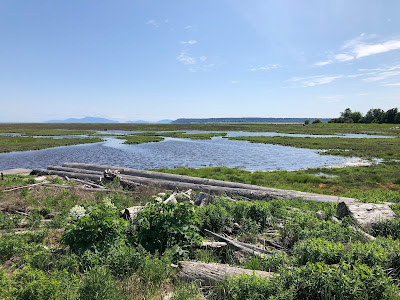
Boundary Bay Wetlands

The currently Regional Growth Strategy, Metro 2040, is under-review as work is proceeding on Metro 2050 which is the next version of the Regional Growth Strategy. One of the areas that is under review is the environmental protection policies in Metro 2040.

Between 2009 and 2014, 1,640 hectares of sensitive and modified ecosystems where lost. Some example of why they were lost include for agricultural uses, logging, and residential development. With this is mind, the regional district is exploring ways to build stronger business cases, policies, and tools to better protect these ecosystems.

The regional district held a forum this summer between policy experts and government as part of the Metro 2040 Environment Policy Review to find ways to plug gaps in current regional environmental policies. The following items were explored:

Improve how we protect our ecologically important areas in our region

  • Implement additional mechanisms to protect, enhance, and connect sensitive ecosystems.
  • Create tools that help place a value on ecosystem services provided by ecologically important areas and include in municipal accounting.
  • Improve information about ecosystem services (including health and economic benefits).
  • Apply consistent policies and approaches across the region.

Explore biodiversity-led regional green infrastructure

  • Develop a common definition of green infrastructure noting the co-benefits for both wildlife and people.
  • Strengthen biodiversity and green infrastructure policies at the regional level.
  • Create a pilot project on biodiversity-led regional green infrastructure.
  • Develop funding and implementation tools for green infrastructure to support projects at a regional and local scale.

Link green space in urban areas to human health.

  • Increase the priority of green space in urban areas (especially new development areas).
  • Coordinate work between local governments and health authorities on green space and human health.
  • Rank public green space and health levels across the region.
  • Set green space targets for municipalities to meet or exceed, require reporting.
  • Develop best practices to optimize health and ecological benefits of green spaces.
  • Increase awareness about the benefits of green space in urban areas.

More details about these three focus areas can be found in the latest Regional Planning Committee Agenda. They will help inform the updated Metro 2050 Regional Growth Strategy which will hopefully further help creating an healthier region.

Thursday, September 12, 2019

Over a quarter of jobs in Metro Vancouver depend on industrial land. Possible measures to protect this land are being discussed.

Because we are a port region, a centre of innovation for technology and manufacturing, and have a large creative sector, industrial land is critical for our economy. For example, the recently announced 600,000 square foot film studio in Langley Township is in regionally protected industrial and employment lands.

Research done on behalf of the Metro Vancouver Regional District shows that 26% of jobs in our region are “dependent on industrial land (including transportation/warehousing/logistics, manufacturing, wholesale, construction, and resources).”

These industrial lands are under threat due to pressures such as being converted for general urban usage for residential, retail, or office space. Even within areas zoned as industrial, due to inconsistent zoning between municipalities in our region, big box retail, offices, and auto dealerships can be found in industrial zones.

Due to the demand for industrial-zoned land, and the encroachment of non-industrial uses into industrial-zoned areas, it is predicted that we will run out of industrial land in about 25 years in our region.

As such, the Metro Vancouver Regional District is looking at ways to preserve and enhanced the industrial land base. The following ideas are being floated as possible tools to ensure that there is enough industrial land into the future:

Provincial Industrial Land Reserve

Working with the province to consider the establishment of an Industrial Land Reserve in Metro Vancouver, similar to the Agricultural Land Reserve.

Strengthening Regional Policy

Improving the definitions and permitted uses on industrial lands, and make it harder to convert these lands to other uses.

Trade-enabling Zoning Districts

Working with the province to grant municipalities the power to define permitted forms of tenure on industrial land. This is currently possible in residential zones.

Zoning Consistency for Industrial Lands

Developing a consistent definition of ‘industrial’ across all municipalities in our region, and ensuring non-industrial uses are not permitted in industrial zones.

Regional Land Use Assessment

Identifying opportunities for more optimized locations and uses for industrial land in our region.

Encouraging Intensification

Loosening any unnecessary restrictions to density or height limits where appropriate in industrial zones.

Mixed-Use: Allowing Residential

Allowing mixed-use industrial/residential within industrial zones that are in immediately proximity to rapid transit as long as it does not result in a loss of available industrial land.

These options will be refined, and will likely be incorporated into a future update to our regional’s growth strategy which must be followed by all municipalities in Metro Vancouver.

Wednesday, September 11, 2019

Only you can help reduce crime. Join Langley City’s Know Your Neighbour Campaign

I helped out during last year’s Know Your Neighbour Campaign.

Yesterday, I posted about last month’s crime statistics for Langley City. Langley City is a safe community, but we do have a challenge with people stealing items from cars and other crimes of opportunity. These are the types of crime that can be reduced when we have strong neighbourhoods where people know each other and look out for each other.

To help facilitate making these connections, Langley City’s Crime Prevention Task Group and its volunteers will be going door-to-door in select neighbourhoods in our community. They will be talking with residents, and giving them information, on how to build strong neighbourhoods by getting to Know Your Neighbour.

The more volunteers that join, the more people that we can connect with to help build a healthier, happier, and safer Langley City.

We need you! Can you spare some time as follows?

Saturday, September 28th from 10am to Noon

Saturday, October 5th from 10am to Noon

Please contact Dave Selvage at dselvage@langleycity.ca or 604-514-2822 if you have questions about the Know Your Neighbours Campaign, or would like to sign-up as a volunteer.

Tuesday, September 10, 2019

Langley City August property crime map released. How you can help reduce crime.

Langley City is a safe community, and this is shown in the crime stats. The likelihood of you experiencing violence due to another person is extremely low. If you do, it is likely from someone you already know.

One of the initiatives of Langley City’s Crime Prevention Task Group (which I chair) is to raise awareness about the types of crimes that do occur in our community, and give people the tools to be part of the solution to reducing crime.

As a result of the Langley City’s Crime Prevention Task Group, monthly property crime maps will now be available to people that subscribe to the City’s monthly newsletter. The map shows both property crime and the location of Block Watch areas.

Langley City Property Crime Map - August 2019. Select map to enlarge.

There are two areas of concern: theft from auto and auto theft.

One way you can help reduce theft from auto and auto theft is by joining a Block Watch. Block Watch is “a community organized RCMP Crime Prevention Program. Neighbours look out for each other. They get to know who belongs and report suspicious activity.”

To join a Block Watch or find out more information, call 604-532-3213.

You can help reduce theft from auto by removing all non-attached items from your vehicle, including garage door openers, and by locking your vehicle.

If you don’t have a newer vehicle with a built-in electronic engine immobilizer, consider purchasing a vehicle alarm or steering wheel lock.

Monday, September 9, 2019

Metro Vancouver Regional District looking to build 500 new units of affordable housing

Metro Vancouver Housing - Sutton Place. Image source: Metro Vancouver Regional District

This weekend, I was at the Triple A Senior Housing Society’s HOPE4HOMES conference. This conference focused on what can be done to make life more affordable for seniors in Langley. Housing is a critical component when it comes to affordability. When people pay more than 30% of their income towards housing, they are living in unaffordable housing.

Seniors in our community who rent are the most vulnerable when it comes to the increasing cost of housing. They are on fixed incomes that are not keeping up with ever-increasing rents. At the conference, I learned that some 3,000 seniors live in unaffordable housing in Langley. Two-thirds of those seniors live in the Township of Langley.

The current federal government and provincial government have committed billions of dollars over the next decade for new purposed-built affordable housing. In BC, the commitment is to build 114,000 new units of affordable housing over the next decade.

The federal and provincial governments are not building this affordable housing, they are providing the funding. They are looking for non-profit housing societies and local governments to build and operate these new affordable housing units.

In Langley, there are around 250 new units of affordable housing being built and operated by non-profit housing societies that is funded through the provincial government. While this is a good start, if we have 3,000 seniors today that need affordable housing (and thousand of younger people who also need affordable housing), we need to be building affordable housing at a larger scale.

The Metro Vancouver Regional District is a federation of municipalities from Langley to Bowen Island. As a collection of municipalities, we have a long history of working together to tackle big challenges.

The regional district provides affordable housing for some 9,000 people today in 49 sites throughout Metro Vancouver. This housing was originally built in the 1970s and 1980s with the support of the federal government. The feds got out of funding new affordable housing in the 1990s until a few years ago. This is one of the reasons why we have a housing crisis today.

With the renewed interest from the feds and province to building affordable housing, it is time that our region gets serious about building affordable housing at scale.

The Metro Vancouver Regional District is looking to collect $4 million per year in new property taxes throughout the region to build at least 500 new units of affordable housing over the next decade. This money will be combined with significant federal and provincial funding, and land donated by municipalities. It is expected that 70% of these units would be low end of market rental, and 30% rent geared to income to ensure affordability.

This $4 million per year would translate to an additional $4 per year in property tax per household in our region.

If this program is successful in the first few years, I hope that the region scales it up because we need to be building thousands of units of affordable housing per year in our region.

I should note that the type of affordable housing in this post is not supportive housing for people transitioning out of homelessness, or who have complex needs. This type of housing with wrap-around services is being handled by other programs.

Thursday, September 5, 2019

Take the Crosswalks within Langley City Survey

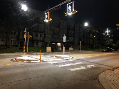
Crosswalk along 204th Street

Since being elected to Langley City council, I’ve heard from many residents requesting more visible crosswalks and new crosswalks in our community.

I wanted to find out if there are certain locations in our community where there is a strong desire from many people to improve an existing crosswalk or add a new crosswalk.

To that end, I’ve launched the Crosswalks within Langley City Survey.

If you are a Langley City resident, please consider completing this survey. It will take around two minutes of your time.

Thank you for your help!

Take the Survey

Wednesday, September 4, 2019

Development Cost Charges: When growth doesn’t pay for growth

Yesterday, I posted about municipal finances and that municipalities in our province have reserve accounts that can be used to pay for things such as upgrading roads, sewers, parks, and the like. In Langley City, we had $34.9 million in reserve accounts at the end of 2018. For a more detailed look at how these accounts are used, please read my previous post. Municipalities also have another special reserve account which I didn’t post about yesterday: Development Cost Charges.

Since the 1950s, there was an understanding that new development projects in a municipality should pay for the services required to support them. Services can include upgraded roads, water lines, sewer mains, and/or park space. Various programs where tried, but the current system of Development Cost Charges was put in place at the end of the 1970s.

While Development Cost Charges are an important funding mechanism for local governments in BC, there are some challenges with the implementation Development Cost Charges.

In BC, the provincial government can technically do whatever it wants to municipalities. The tradition has been very hands-off when it comes to the province intervening in municipal matters. This means that municipalities have a high degree of autonomy when it come to finances.

For example, councils generally work with municipal staff annually to approve projects such as upgrading roads or building a new performing arts centre, and determine how these projects will be paid for.

Development Cost Charges are different. The provincial government must approve every project that will be funded by a Development Cost Charge; municipalities must create a bylaw for these projects for provincial approval.

Generally, Development Cost Charges can be used to widen roads, build bicycle infrastructure, build sidewalks, build water mains, build storm water mains, build sewer mains, and to acquire and improve parkland. This seems simple, but it is not.

The rules for what projects in these categories are eligible for Development Cost Charge funding is very complex. In fact, a 116-page guide is available from the provincial government on Development Cost Charge implementation.

An example of the complexity is that funding collected by Development Cost Charges can be used to build a washroom in a park, but can’t be used to build a spray park. A baseball diamond could be funding by a Development Cost Charge, but a tennis court could not.

Development Cost Charges are geared towards communities that are building new neighbourhoods, and not for communities like Langley City where redevelop is occurring. This means that in Langley City, projects which should be paid for by Development Cost Charges, can end up being paid for by general revenue from existing residents.

Langley City and other municipalities in BC are advocating to the provincial government to make the Development Cost Charge program less restrictive, especially when considering redevelopment.

At the end of 2018, Langley City had $17.6 million in restrict Development Cost Charge reserves.

Tuesday, September 3, 2019

What’s with Langley City’s $297 million financial accumulated surplus?

When most people think of financial surpluses, putting money into bank accounts and investments is something that likely comes to mind.

In Langley City, we had a $12.7 million surplus in 2017 and an $11.3 million surplus in 2018. Does this mean that the City is placing tens of millions of dollars into savings accounts and investments every year, all while claiming we have limited financial resources? Absolutely not!

Municipal financial plans have two kinds of expenses: operating expenses and capital expenses. Operating expenses are for things that generally occur every year such as paying employee salaries, painting lines on the road, and paying Metro Vancouver for water and sewer.

Capital expenses generally occur for one-off items that generate a tangible asset. Tangible assets include things like roads, water pipes, sewer pipes, streetlights, playground equipment, park trails, and garbage cans.

When you look at Langley City’s “Expenses” of $45.3 million in 2018, these were operating expenses. The surplus section is mostly capital expenses; creating and renewing tangible assets.

So, what was the breakdown of Langley City’s accumulated surplus at the end of 2018?

$3.9 million was an operating surplus. This can occur due to things like snow removal budgets being used less than expected. This also occurs due to staff vacancies that occur during the years, and when new staff positions are created. Any operating surplus is generally transferred into reserve accounts where the surplus can then be used for capital expenses.

$34.9 million is Langley City’s reserve accounts. These accounts are generally used for acquiring capital assets.

Because some projects can take multiple years to complete, when council allocates funding for a capital project in a year, it doesn’t mean that the project will be completed within that same year.

For example, council is planning to upgrade Glover Road to include safer bike lanes. Each year, we are adding to our reserve accounts for this project until we have enough money to complete the project.

Once a project is completed, its dollar value is converted into “equity in tangible capital assets.”

In Langley City, we have $257.9 million in these tangible capital assets at the end of 2018. This represents 87% of our accumulated surplus.

This is the book value of our capital assets. For example, if we spend $10 million on a road project, and that road had an expected life of 20 years, each year $0.5 million would be taken out of the accumulated surplus.

If a city’s accumulated surplus is going down in value, the city's assets are falling into a state of disrepair. Even if a city’s accumulated surplus is increasing, it doesn’t mean that the state of a city’s infrastructure is healthy.

If there was no increase in population and no new development, the accumulated surplus should grow at the rate of inflation. Because of population increase and development, the accumulate surplus should grow at a rate higher than inflation.

In Langley City, our accumulated surplus is growing at the rate of inflation. This means that more investment is needed to keep all our existing infrastructure in a state of good repair. This is why we are now working on an asset management plan.

In a healthy community, the accumulated surplus should be increasing year-over-year. While some of this surplus is investments and cash that will be used to pay for things such as roads, pipes, and parks, the majority of this surplus represents the infrastructure that already existed in a community.