Thursday, January 30, 2014

Improving the usability of transit in Metro Vancouver

Yesterday, I posted about how our transit system in Metro Vancouver is pretty good compared to other systems in North America. While our system is great, there is always room for improvement. Of course everyone wants to see more service and more rapid transit, but there are other changes that could be made to the system to improve its usability without requiring a referendum.

One of the barriers to use transit for many people is the perceived or actual idea that transit is hard to use and inconvenient. When designing a transit system, using a tourist as the baseline user is critical. If a tourist can use the system with ease then locals should also have a great experience when taking transit.

One of the good things about TransLink is that it appears to look at other transit systems throughout North America and adopt their good ideas.

For example, the “T” logo that is appearing at some SkyTrain stations throughout the region looks like they were borrowed from Boston’s MBTA. The signs provides a simple, easy to identify clue that rapid transit is nearby.

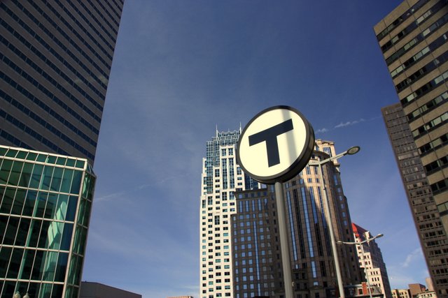
Boston "T" sign which shows that a rapid transit station is nearby. Select image to enlarge. Picture Souce: Some rights reserved by BostonPhotoSphere.

Another example is the next station maps that are starting to appear at SkyTrain station. This seems to be based on Washington, DC's Metro system and provides confirmation that people are indeed waiting at the correct track for their desired train. There are some things that TransLink could improve.

Platform sign at Metro station in Washington, DC. Select image to enlarge.

One of my pet peeves about transit in Metro Vancouver is bus stops that only say “Bus Stop”. These signs are poorly designed because they doesn’t tell you what bus(es) service the stop or the terminus of the route(s). I have taken transit buses in Seattle, Portland, San Francisco, Boston, New York, Philadelphia, Washington, DC, Calgary, and Edmonton. Every single bus stop tells the route number and terminus. TransLink really needs to consider updating bus stop signage to match what pretty much every other transit agency in North America does.

Another annoyance in our region is that people at the platform don’t wait for people to get out of SkyTrain before trying to board. In Washington, DC, at every stop they announce to wait for people to get off the train, before getting on the train. They also announce for people to move to the centre of the train. While this may be annoying, I think this is the kind of reminder we need in Metro Vancouver.

In Vancouver, we have yellow tiles that mark the dangerous edge of the platform at SkyTrain stations. In Washington, DC, they installed lighting at the platform edge that blinks when a train is arriving. This provides a good visual clue to stand clear of the platform edge, and also is a good accessibility feature for people who might not hear the train coming.

One of the things I noticed in Portland, Philadelphia, and Washington, DC is that buses have visual and auditory announcements about the next bus stop; similar to what is on TransLink buses. These US transit agencies also show and announce when the next bus stop is a transfer point to other routes by showing and announcing those routes. This is something that TransLink should consider implementing on its buses.

As you know, TransLink is implementing the Compass Card smartcard fare payment system. Philadelphia is also implementing a smartcard fare payment system. The Philadelphia system will accept debit and credit tag-enabled cards, phones with a NFC payment app, and the transit agency’s own smartcard. TransLink's system is also technically able to accept the same things, but right now TransLink is only focusing on implementing its own smartcard. Enabling the acceptance of debts and credit cards on buses in our region will lower the barrier to entry for potential transit users in the region.

Faregates do nothing but cause hassle to transit users. Of the transit systems I’ve been on, I always saw at least one person having an issues with faregates. All transit systems with faregates have attendants near the gates because of this. TransLink will need to ensure that there is staff available to assist when someone cannot get into or out of the transit system. I personally can’t stand faregates as 90% of the issues I've had on transit throughout my journeys in North America have be around faregates.

With the exception of faregate attendants, all the suggestions to improve the end-user experience of transit in our region would not require increasing TransLink's operating budget.

Wednesday, January 29, 2014

TransLink ain't that bad compared to SEPTA or WMATA

It seems that every day TransLink is in the news for something. The transit agency has become the whipping boy for all that is wrong with transportation in our region. For the last five days, I was in Washington, DC and Philadelphia. While in both cities, I used transit to get around. SEPTA is the name of the largest agency in Philadelphia and WMATA (Metro) is the name of the largest agency in Washington, DC. They are some of the busiest transit agencies in North America. Whenever I come back home, I’m always reminded at how good our transit system is and how well it actually works.

One of the thing that I’ve heard in Metro Vancouver is a call for TransLink to be broken up into smaller agencies. For example, some people are calling for a South of Fraser transit agency. This would be the worst thing possible. One of the things that makes our transit system easy to use is that one monthly pass or single-fare ticket can get you access to the whole system.

Philadelphia is served by three transit agencies: SEPTA, PATCO, and New Jersey Transit. Washington, DC is served by five different transit agencies. On a typical commute, one may need to purchase passes or fare products from multiply agencies. Beyond that, figuring out what to pay and what passes you need within the same agency can be confusing. Even how to pay can be confusing.

Philadelphia’s SEPTA has to have the most arcane fare system of any mayor city in North America. While SEPTA is currently working on introducing a smartcard payment system, it is several years out from going into full service. SEPTA has an eight-panel brochure that outlines the different fare options and pricing.

SEPTA’s transit operations are also very people heavy. Each transit station has a handful of agents that collect cash payments, or punch tickets and passes. Each commuter train has at least two conductors that actually collects cash payment onboard.

Actual ticket received when paying on board a SEPTA regional rail train. Click image to enlarge. And you though TransLink was confusing!

While in Vancouver, we can pay with cash, credit, or debit at transit stations; SEPTA is a cash-only affair expect for a few stations where you can use electronic payment to purchase fare products directly from a fully-staff SEPTA ticket office.

People like to say that TransLink is full of fat, but I suggest they look at other transit agencies throughout North America before making that judgement call.

One of the other things that we take for granted in Metro Vancouver is that when we purchase a ticket, it is good for 90 minutes. A pass is good on all forms of transit in our region. This is not the case in Philadelphia or Washington, DC. A ticket is only good for one ride (though both SEPTA and WMATA offer discounts when transferring). In Washington, DC, you actually need to purchase a separate bus pass and rail pass from WMATA!

One of the reasons that was used to justify the installation of faregates in Metro Vancouver was that they provide more perceived safety. I can tell you this is not the case. In both faregated Philadelphia and Washington, DC, most of the transit stations are poorly lit. In Philadelphia, many of the stations must also be accessed by winding, seemingly endless underground corridors. The combination made me even feel uncomfortable. It certainly is a contrast to the brightly lit, and easily accessible stations on TransLink.

Of course both SEPTA and WMATA do many things right, some of which TransLink should consider implementing. I’ll save that for another post.

TransLink is not without its flaws, but we have a great system and a solid foundation for expansion in the future.

Thursday, January 23, 2014

Transportation Lecture - Next Tuesday

I received the following invitation in my inbox that I thought I'd repost to the blog. I would go to this lecture, but I'll be in chilly Philadelphia and Washington, DC. When I get back, I'll post about my transit experience in both regions.

Breaking the Political Gridlock to Address the Transportation Challenge: Lessons Learned from the Greater Toronto and Hamilton Area, lecture by Dr. Anne Golden takes place on January 28 at 7 pm at Djavad Mowafaghian Cinema, Goldcorp Centre for the Arts (at SFU Woodwards), 149 West Hastings, Vancouver. Admission is free, but reservations are required. RSVP here: www.sfu.ca/rethinking-transportation.

Dr. Golden brings the unique and relevant experience of leading the Transit Investment Strategy and Advisory Panel in its recent work on identifying a viable transit investment strategy for the Greater Toronto and Hamilton Area. She will describe the political and financial context that was blocking progress in Toronto, and set out Making the Move, the plan that she and her 12 panel members hope will break the political and transportation gridlock.

Like Metro Vancouver, which will add one million new residents over the next 30 years, the Greater Toronto and Hamilton Area is projected to see its population increase by 40 per cent in the next 20 years. Both Metro Vancouver and Toronto are seeking ways to give their residents new transportation choices, ease congestion, better connect people with jobs, and enable people to travel efficiently in all directions.

This is the first lecture in the speakers’ series ‘Rethinking Transportation: New Voices, New Ideas’. The series, focused on key transportation issues and opportunities facing the Metro Vancouver region, will explore new perspectives on the movement of people and goods in cities with thought leaders, decision makers, and experts from across North America who have tackled some of the most pressing transportation challenges.

For more information and to RSVP, visit the lecture page: www.sfu.ca/rethinking-transportation.

Wednesday, January 22, 2014

The demise of the South of Fraser Area Transit Plan

In 2007, TransLink completed the South of Fraser Area Transit Plan. This plan outlined the long-term vision, and also a mid-term implementation plan for improving transit service in Surrey, Delta, White Rock, and Langley.

The implementation plan went until the end of 2013. With 2014 underway, I thought it would be interesting to see what was promised, and what was delivered.

According to the implementation plan by the end of 2013, the South of Fraser should have an additional 170 buses and associated operation staff. These buses would be used to increase transit service in the area. Some of the major projects to be completed should have been:

-Expansion of the frequent transit network
-Expansion of community shuttle service, including new service in Willoughby, in Langley
-New South Surrey/White Rock Transit Exchange
-New Newton Exchange
-New Langley Bus Exchanges at Willowbrook and Langley City to accommodate rapid bus service
-New median busway along King George Boulevard with B-Line service between White Rock, Surrey City Centre, and Guilford
-Well underway with the construction of a busway along Fraser Highway with B-Line service between Surrey City Centre and Langley
-Highway 1 busway including Carvolth Park and Ride

Map of proposed transit network to be implemented by the end of 2013. Click map to enlarge.

TransLink was able to expand the frequent transit network and also add new community shuttle service, but not at the service level envisioned in the area transit plan and with no new service in Willoughby and no frequent transit along 152nd Street.

TransLink was only able to add partial B-Line service along King George, but without a busway and not to White Rock. There is no busway along Fraser Highway and no B-Line service.

While the Carvolth Park and Ride was completed, TransLink was only able to add partial service between Langley and the SkyTrain with no service through Surrey, or service to Abbotsford.

While TransLink was able to implement many of the service improvements envisioned in the 2007 to 2010 timeframe, the implementation plan placed many of the major service improvements in the 2012/13 timeframe. This is the same timeframe when transit expansion was halted in the region by the province and the mayors.

The sad reality is that the implementation plan for 2007 to 2013, could also be the implementation plan for 2014 to 2020, as so many major projects were not completed.

With the upcoming transit referendum, the region may have the chance to vote to get transit expansion back on track, but if the referendum fails or the province continues to play games with transit, TransLink might as well put all of its service improvement plans in the recycling bin.

Tuesday, January 21, 2014

Economic justification for highway projects, and why the province’s tolling policy is making things worse

Last week, I posted about highway expansion in Metro Vancouver. One of the things I talked about was the need for comprehensive tolling in the region because the current piecemeal tolling policy is only shifting congestion around. But why is this?

When governments building new or expanded highways, they normally say things like “this project will bring $5 billion in economic benefit to residents in Metro Vancouver.” These large numbers are used to justify the cost of highway projects. Where do these large numbers come from? They come from a travel time benefit analysis.

The BC government claims that the Port Mann Bridge/Highway 1 project will save people up to an hour per day in commute time. To get a dollar value from time saved, a time travel benefits analysis will take 25% to 50% of a person salary and multiply it by the hours saved. For example, the median household in Metro Vancouver makes about $30 per hour. A time travel benefit analysis would value an hour of travel saving for the median household at $7.50 to $15.00 per hour.

To get big impressive numbers, governments multiplying the benefit price by number of people that use a facility. For example, if an hour of time saving was calculated as $7.50 and 30,000 households crossed the Port Mann in one day, there would be an economic benefit of $225,000 per day. Per year that would be $58.5 million. Over the lifetime of the Port Mann Bridge (40 years), the benefit would be $2.34 billion.

So when the province introduced a daily toll of $6 per day, it naively thought that people will do a time travel benefit analysis, realize they are still getting more benefit than cost, and will pay a $6 toll. Some people do, but the model assumes that all people are rational economic actors.

Of course we know that people aren’t very rational or as simplistic as economic models like time travel benefit analysis are based on. For example, people will wait in lines for hours to save a couple bucks during Boxing Day, or spend an extra hour commuting to avoid paying a toll. This would explain why the Port Mann Bridge and Golden Ears Bridge are traffic diverters. This would also explain why putting a small toll on all major crossing would actually reduce congestion more than a simple economic models would predict. What is certain is that the current piecemeal tolling policy in our region is actually making things worse.

Transportation is a complex system because it is based on human behaviour and not rational economic actors. Todd Litman has a great paper on the topic called “Valuing Transit Service Quality Improvements” which goes into more detail about what I just talked about, and talks about other factors that should be considered around transportation systems.

People value time differently. For example, I could drive to work in an hour. I choose to take transit which takes about 1.5 hours. Besides the economic saving from using transit, on transit I can write a blog post, catch up on email, or watch my favourite TV shows. I can’t do that driving. The time being on transit is more valuable to me than time being stuck in a car.

Monday, January 20, 2014

Opposing Density in Willoughby

Before the Christmas holidays, a development proposal went before Township Council to build housing between 82nd Avenue and 84th Avenue, just north of the Church of Jesus Christ of Latter Day Saints' Langley Temple. The proposed project included 153 single-family houses, 8 duplexes, 29 rowhosues, and 54 townshouses. The higher-density housing was to be closest to the temple. According to an article in the Langley Times “church elder Paul Christensen said higher density housing nearest the temple, as called for in the current design, could lead to problems with people using the temple parking lot”. It was almost implied that multi-family housing, and the people who live in multi-family housing, were less desirable than people who live in single-family housing.

The project was defeated in a tie as one council member, Bev Dornan, was away. Because of the tie, Township Mayor Froese brought the project back for consideration last Monday, where it passed.

Tonight, the Township of Langley will be holding a public hearing. One of the items on the agenda will be a proposed housing development with multiply housing types from single-family housing to 6-storey apartment buildings.

Proposed site plan for development just south of Willoughby Town Centre which includes 6-storey apartment buildings. Click image to enlarge.

This proposed development is part of a larger development planned around the under-construction Willoughby Town Centre. The project will incorporate an extensive greenway systems with housing density that steps down from the mixed-use town core. The end result should create a successful walkable node. Because of the proposed 6-storey apartment buildings, there is likely to be some opposition to the project.

Overall plan for residential build-out around Willoughby Town Centre. Click image to enlarge.

Opposing density in Willoughby is nothing new. Population and density has been increasing in Willoughby, but the majority of projects to date have been residential or auto-oriented. To do pretty much anything in Willoughby requires a car. This creates parking and traffic problems.

Unfortunately people are starting to associate density with problems in the community, when the real issue is that Willoughby is a community without a core. Willoughby Town Centre is under construction, and there are plans to build a walkable transit village around the new Park and Ridge, and walkable nodes throughout the community, but these projects will take time to complete. In the meantime, I think that people are become more frustrated.

Unfortunately, the original plans for Willoughby didn’t incorporate sustainable community design principles. The Township has been playing catch-up with their plans over the last few years. Building mixed-use nodes will be key for the successes of Willoughby, I only hope that Township Council understands this and doesn't put the brakes on mixed-use projects during this transition period.

Of course having inadequate transit in Willoughby doesn’t help, which is a why voting to increase transit funding this fall will also be key to the further successes of the community.

Thursday, January 16, 2014

Shifting Congestion: The Port Mann Bridge and Massey Tunnel

The multi-billion dollar South Fraser Perimeter Road and Highway 1/Port Mann expansion projects were not even completed when the Provincial Government announced that it planned to replace the Massey Tunnel. The Port Mann Bridge/Highway 1 project has had a profound effect on our transportation system in the region, and likely not in the way that the province intended.

Tolling was always part of the Port Mann/Highway 1 project. Without tolling, the province couldn’t have afforded to build the project, and the province's own research showed the highway would have filled to capacity in five to ten years. It is no surprise that traffic volume are down across the Port Mann Bridge.

One of the stated goals for Port Mann/Highway 1 project was to reduce congestion. While that may be true along the Highway 1 corridor, congestion has increase along other corridors. I find it amusing that the original Project Definition Report for the Gateway Program stated that “to effect diversion at the Port Mann Bridge, tolls in the range of $5 to $8 per trip would be needed.” In then goes on to say that:

If tolls were introduced on the Port Mann Bridge, it would affect traffic on the Pattullo and Alex Fraser bridges. Some users of the Port Mann Bridge would choose to use these crossings instead of paying a toll. Traffic modeling indicates that the volume of traffic in 2021 would not be appreciably different on the Pattullo and Alex Fraser bridges than it would be if the Gateway Program was not built.

With the completion of the South Fraser Perimeter Road and accompanying signage on the Highway 1 corridor, the province is practical telling people to take the Pattullo Bridge.

Back when the Gateway Program started, Metro Vancouver and TransLink had major concerns about the project. They would only support the program if, among other things, there was an “introduction of tolls and other transportation pricing mechanisms to fund, manage demand and promote efficiency in the use of the transportation system.” The region also wanted to ensure that the province did not promote the Pattullo Bridge as a free alternative to the Port Mann. Of course, the province didn’t listen to the requests from the region.

Metro Vancouver also has concerns around the province’s plan to replace the George Massey Tunnel, and has asked TransLink to put together a comprehensive analysis on the effects it could have on our regional transportation network.

What I find interesting is that in the Gateway Project Definition Report, the province acknowledges that “to capture sufficient benefits [from replacing the Massey Tunnel] would also require improvements to other crossing over the North Arm of the Fraser River such as the Oak Street or Knight Street bridge, or a new crossing to serve projected commuting patterns associated with employment growth in central Burnaby.” Of course that would also mean widening roads in Vancouver and Burnaby which would be impossible.

Of top of that, if the Massey Tunnel replacement is tolled (which it will need to be), more congestion will result on the Alex Fraser Bridge as it will promoted as the free alternative.

If the province was really serious about reducing congestion in Metro Vancouver, it would allow region-wide tolling and would also support improving transit. System-wide tolling and transit has been proven the world over to actually reduce congestion. Sadly, I think the Massey Tunnel is simply good ol’ BC blacktop politics as even the province's own documents say it will have limited benefit to the region.

Wednesday, January 15, 2014

Parking, roads, and density in Willoughby

Last month, there was an article in the Langley Times about residents in Willoughby who went to the Township Hall because of the removal of “temporary” parking along 80th Avenue, which is designated as a major thoroughfare, and the increased speed of traffic as a result of the widening. To me, this brings up several issues which need to be addressed.

People like the idea of high-speed roads that get them quickly from point A to point B, but they only like those high-speed roads when they don’t go through their own neighbourhoods. And who really would want a high-speed road going through their community? Would you really want to have your yard fronting 200th Street or Highway 10? High-speed roads create noise pollution, air pollution, and vibration which reduce the quality of life of people living near these high-speed roads, and also increases the risk of chronic health conditions. Furthermore, high-speed roads increase the risk of fatalities of all roads users: motorists, cyclists, and pedestrians. How many parent wouldn’t have issues allowing a child to cross 200th Street? That fact that no one wants a high-speed road through their neighbourhood really points to the fact that we understand, deep-down, that an auto-oriented community is not a good thing. I am sure people in Willoughby will not be impressed when some sections of 208th Street are widened to 6-lanes.

On the flip side, people are willing to pay a premium to live in a walkable community. Think of Fort Langley. There are no high-speed roads through that community, and the removal of the Albion Ferry and its associated traffic improved the livability of that community. Walkable communities also support transit and cycling, and it’s no surprise that people are willing to pay a premium to live near high-quality transit.

One of the other issues in Willoughby is parking. It is interesting that people blame density as the root cause of parking problems, but the root cause is that driving is the only transportation option in Willoughby. Of course single-family home residents like blaming townhouse residents for parking problems. Just as townhouse residents like blaming apartment residents for parking problems. Having lived in all three types of housing in Langley, it is likely illegal secondary suites in single family homes that are causing parking problems in a number of cases, as well as people converting their garages in single-family housing and townhouses into habitable space or storage. In fact, apartment residents are the best behaved because it is virtually impossible to transform assigned, shared parking into anything else. The point is that everyone is part of the parking problem, but there is a solution.

People like an even playing field, and the Township of Langley will never be able to remove all the illegal conversion of garage space and secondary suites in the community. Many communities with limited parking in residential areas introduce permit parking. As I’ve said in the past, the Township of Langley needs to seriously consider the introduction of permit parking systems in residential areas with parking difficulties. The system should be funding on a cost-recovery basis which each household being able to purchase 1 or 2 annual permits from the Township for their area. If people don’t need the permits they could sell or give them to people that do. It would be like cap and trade, but for parking. Of course, even with permit parking, short-term visitor parking would be allowed without a permit. This is nothing new and has been used successfully in community throughout North America.

The challenge in Willoughby today is that up until a few years ago, it was designed as an auto-oriented community. With the introduction of the transit village around the new park and ride, and walkable nodes at key intersections, the Township has a chance to correct this mistake. These nodes will also support increased transit which Willoughby desperately needs. Many people see density as the problem in Willoughby, but the really problem is that it is an auto-oriented community. While residential areas in Willoughby can support transit, the commercial areas are still very much auto-oriented. Building walkable nodes that support a multi-modal transportation system throughout Willoughby is the solution, I can only hope that Township Council understands this and doesn’t make any knee-jerk decisions.

Tuesday, January 14, 2014

Township of Langley Budget Consultation Results

As part of the budget process, the Township of Langley hosted open houses and provided an online questionnaire for residents to submit their feedback about the municipality’s financial plan. The Township also has an online “Citizen Budget” simulator to get feedback about people's priorities for municipal services as well as education people about the budgeting process. The Township of Langley plans to increase taxes as follows:

General Inflation 1.32%
Capital Contribution to Fire and Fleet Vehicle Replacement Reserve 0.39%
Future Aldergrove Facility 0.10%
Infrastructure Levy 0.78%
Total Universal Services Property Taxes 2.59%

Solid Waste User Pay Levy 2.79%
Sanitary Sewer User Pay Levy 2.79%
Water User Pay Levy (includes 2.93% for East Langley Water Supply) 5.72%

Water, sewer, and transportation are the top three items that the proposed tax increases will support. Digging a bit deeper, it appears the Township has been investing heavily in putting water and sewer service through East Langley to Aldergrove. Combined with the tax increase to pay for the Aldergrove Community Centre, it appears that rural and Aldergrove residents are getting good value by being in the Township.

One of the things that does concern me is because of the new water and sewer infrastructure in rural Langley, and especially in areas like Salmon River/Uplands, there is going to be increased pressure to urbanize these rural areas. I’m most concern about Salmon River/Uplands as most of that area is not in the Agricultural Land Reserve, and it has been lack of Metro Vancouver sewer and water service that has actually limited growth in that area.

The Township of Langley had 168 people submit feedback via the questionnaire and 24 people submit feedback via the “Citizen Budget” tool. To me this shows that people are generally OK with municipal spending. Normally more people attend municipal open houses when they have concerns, and given that Township residents will pack the municipal council chamber to oppose apartment buildings, people in the Township know how to make their voices heard.

Yesterday, I posted how City of Langley residents support municipal services over tax cuts. The same is true in the Township with only about 25% of the questionnaire respondents opposing the proposed tax increases. In the “Citizen Budget” tool, participants were asked if they got good value for their tax dollar. 10% said they received very good value, 55% said they receive fairly good value, 10% said they received fairly poor value, and 25% said they received very poor value.

The Township also asked for people's feedback on specific budget items. There was strong support to increase the number of fulltime firefighters, implement traffic calming measures, install a signalized crosswalk at 216 St and 88B Ave in Walnut Grove, and improve streets in Brookswood. In fact, many people comments on the need to sidewalks in Brookswood.

Monday, January 13, 2014

2013 City of Langley Community Survey

Every three years, the City of Langley conducts a Community Survey. The Community Survey gives an indication of what residents feel about the quality and delivery of municipal services. It also gauges top-of-mind issues for people in the community. I’m sure it is not intentional, but this survey has always been released during municipal elections years; the City released previous surveys in 2004, 2007, and 2010.

The survey is based on 600 telephone interviews from Langley City residents over the age of 18. While the survey provides weighted sample characteristics, I have to wonder if the survey weighting true represents the demographics of people that live in the City.

Even though the Langley City has received a lot of attention around crime over the last few years, 95% of City residents rate quality of life as good or very good. This has remained constant since the survey started in 2004. The top three reasons that people cited for why quality of life is improving is because of growth/development, better/more services, and improved public safety. Though on the flip side, reasons cited for a reduction in the quality of life in the City include increased crime and poverty. Interesting enough, population growth was also cited as a reason for a reduction in the quality of life. Some people might equate population growth with more congestion and a reduction in quality of services.

Transportation is the number one issue that residents want the municipality to focus on. Top concerns are the condition of streets, sidewalk, and lack public transit. While transit is a regional/provincial issue, the City can do more to improve the quality of our streets. Residents also want the City to improve the aesthetic of boulevards.

One of the thing that I’ve been advocating for is wider sidewalks, separated bike lanes, and street that create a great public realm. These are called “Complete Streets”, and we need more of them in Langley. These streets would build an accessible community and would address residents’ concerns about quality of street in the City. Building these streets would fix “pothole” problems, and could be built when replacing water and sewer infrastructure that is hitting its end-of-life.

Other issues that residents want the City to continue to focus on is crime-reduction and addressing social issues like poverty, homelessness, and substance abuse in the community.

One of the thing that I’ve always believed is that local and regional government impact people’s lives more directly that other orders of government. I also believe this is why people support local government services. The survey results indicate that 84% of residence believe they receive good value for the municipal tax dollar. Given the choice between cutting taxes or reducing services, only 29% would cut taxes.

The survey also spent some time going into issues in Downtown Langley. While 98% of people feel safe in Downtown Langley during the day, the number drops to 54% in the evening. This is no surprise giving that the Downtown becomes a ghost town after 6pm. More redevelopment, included mixed-use and pedestrian-oriented projects, will bring more residents to the Downtown core. This will go a long way to improving the perception of safety. Having more people in the area will support coffee shops and restaurants staying open later which will further increase the perception of safety.

The infrastructure in Downtown Langley is getting worn down which impacts the perception of safety. As I mention earlier, the City needs to focus on building complete streets. Building complete streets in Downtown Langley, and on major roads that connect to Downtown Langley, should be a priority and will go a long way to improving the public realm and perception of safety.

The survey asked for the first time if residents had difficulty finding parking in Downtown Langley. 40% said they did, though the survey doesn’t give reasons why. What’s clear is that the City and the Downtown Langley merchants really need to reevaluate their parking policies. More surface parking lots and drive-thrus are not the answer. I believe that managing the existing parking supply should be a priority.

While most people are happy with life in the City of Langley, there are opportunities to truly make the community “the place to be”. The full survey results are available in tonight’s council agenda.

Thursday, January 9, 2014

Coal Trains, Container Trains, and Port Expansion

I’ve been following Port Metro Vancouver over the last several years in relation to the expansion of Deltaport, called the Roberts Bank Terminal Two Project, and also the proposed expansion of coal exports through our region.

While the proposed expansion of Deltaport will bring many positive economic benefits, those benefits are not spread equally throughout the region. Also, there are negative economic, social, and environmental externalities that may result from of the expansion.

If you are unlucky enough to live by a rail line, like people in the City of Langley or Fort Langley, you will be subject to more rail traffic. If you live next to a rail line, you are at higher risk of chronic health conditions. In the City of Langley, the community will be cut off from the rest of the region as “the Roberts Bank Rail Corridor currently carries approximately 22 trains per day, which is expected to increase to 28 to 38 trains a day with completion of the third birth at the existing terminal in 2016/17. Current trains can be up to 3.2 kilometres in length. With the addition of the RBT2 Project, rail traffic may potentially increase to over 60 trains per day.” This may also have a negative impact on the economic prosperity of the City of Langley or any other area in which we see this massive increase in train traffic.

Of course much can be done to mitigate these negative impacts. Early this week, the Canadian Environmental Assessment Agency announced that the proposed Roberts Bank Terminal 2 Project will be reviewed by an independent panel. Even with an independent review panel, the Harper Government has final say on any project. Since the Port is a federal agency, I have no doubt that this project will be approved.

Hopefully, the review panel will recommend measures that will lessen the negative impacts due to the proposed expansion and that the Harper Conservatives will listen to the panel.

Besides expanding Deltaport, Port Metro Vancouver is also looking at pumping more coal shipment through our region. This has both the US and our local health authorities very concerned as the burning and shipment of coal can have devastating impacts on human health. Many municipalities, including the City of Langley, have written letters of support of our health authorities in calling for the Port to complete a Health Impact Assessment for the proposed increase of coal shipments.

Late last year, the Port submitted a half-baked “Health Impact Assessment” that left many questions unanswered, and didn’t impress our local health authorities, which are still calling for a proper Health Impact Assessment.

The City of Langley Council will be hearing, and could approve, a motion on January 13th to send a letter to Port Metro Vancouver once again calling for a proposed Health Impact Assessment. I’m hopeful that since Council called for a Health Impact Assessment in the past, they will support this motion.

Without addressing the serious health impacts from the shipment of coal in our communities people that live in the City of Langley, White Rock, South Surrey, and Delta will be at a higher risk of premature health and chronic illness. I recently learned that toxic mercury released by the burning of coal in China is making its want back across the Pacific Ocean and is contaminating the drinking water in San Juan County. Our water in Metro Vancouver could face the same risk.

While the Port is an important generator of economic prosperity in our region, we have to make sure that the economic benefits are received by as many people as possible, and not at the expense of the livability of our region.

Wednesday, January 8, 2014

More than you wanted to know about bus procurement at TransLink

When I was researching the Federal Gas Tax funding —used to fund capital projects at TransLink— which I posted about yesterday, I came across a presentation for the Metro Vancouver Transportation Committee that was given by Bob Paddon of TransLink. As I said yesterday, some politicians have been complaining that TransLink hasn’t been using the federal funding to expand transit service. Some of those same politicians have also been complaining that TransLink is wasting money buying new buses because it has nothing better to do with the federal dollars.

When TransLink was audited twice in 2012, one of the recommendation was to reduce the amount of spare vehicles. TransLink is reducing its ratio of spare vehicles from 25% to 20% (the Canadian average is 22%). Even with this reduction, old buses still need to be replaced. TransLink's replacement schedule for vehicle is as follows:

40' and 60' conventional buses: 17 years / 1,000,000 km
Community Shuttle buses: 6 years / 450,000 km
HandyDart buses: 6 to 8 years / 200,000 to 250,000 km

Some people can get very existed about transit technologies, including the fuel types that are used in buses. The presentation included the following table that outlined the benefits and drawbacks of certain fuel types. Trolley buses are not included. Trolley buses have substantially lower energy costs than diesel, work great on hills, and are best in stop-and-go traffic. Their main drawback is that they are capital-intense.

Hybrid Diesel-Electric:
-Best for use in urban core areas with a lot of stop-and-go
-Lower emissions than Diesel or CNG overall

Compressed Natural Gas (CNG):
-Lower fuel cost than diesel
-Best for use in suburban settings with longer distances between stops
-Slight emissions advantages over diesel
-Do not perform as well as hybrids or Diesels in urban settings

Diesel:
-Appropriate for conventional vehicles in urban & suburban settings, and where CNG buses cannot operate near Trolleys
-Greatest operational flexibility
-Excellent performance on Vancouver’s steep hill

Of course what I found really interesting is TransLink's renewed interesting in compress natural gas (CNG) buses. Likely this is due to the province's full-scale embrace of all things natural gas. TransLink is planning to spend $5 million to allow CNG buses to operate in the South of Fraser. On an aside, it appears that the province is betting the farm on natural gas as a solution to all our budget woes. This is interesting because one of the reasons why TransLink has committed to expanding its CNG fleet is because “a significant drop in the price of CNG has resulted in favourable pricing. CNG is currently substantially less costly per kilometre than diesel.”

So while TransLink is far from perfect, it appears that its vehicle replacement strategy is not out-to-lunch.

Tuesday, January 7, 2014

TransLink, Metro Vancouver, and the Federal Gas Tax Fund

Starting in 2005, the federal government introduced the Gas Tax Fund which deliveries about $2 billion annually to municipalities in Canada for capital projects. In our region, Metro Vancouver decided to commit 100% of this federal funding to TransLink.

Since 2005, $676.9 million has been used to expand the bus, SeaBus, and SkyTrain fleets. The funds have also been used for the Compass Card program. Besides expanding the fleet, the funding has also been used to keep our transit system in a state of good repair. Funding has been used to replace buses at the end of their service life and also for keeping the SkyTrain system in a state of good repair with projects such as retrofitting the old SkyTrain vehicles, replacing the power system on the SkyTrain network, and upgrading SkyTrain’s communication and control system, which has not been upgraded since the 1980s. Funding has also been used to upgrade bus maintenance and operations centres.

In late 2013, there was grumbling by some in Metro Vancouver that TransLink wasn’t using the money to expand the transit system, and even suggested taking away the federal funding from TransLink. The loss of approximately $120 million dollars a year, or 8% of TransLink’s revenue, would further degrade transit service in Metro Vancouver.

As you likely know, TransLink is unable to expand the transit system as there is currently not enough revenue; the province and mayors are playing a game of chicken over a new source of taxation, and the independent TransLink Commissioner wouldn't allow a fare increase beyond inflation. This means that if TransLink was to use the money to expand the SkyTrain or bus fleet, there would be no money to have people operate the new vehicles or maintain them. When there is no new funding for operations, it really doesn’t make sense to buy vehicles to expand service.

Of course even if there was funding to expand the transit network, money would still need to be spent to keep the existing system in a state of good repair. One of the big mistakes made in the US is to spend money on expanding transportation systems, but not maintaining the current systems. This is why bridges are failing into rivers in the US, for instance. Also, “deferred maintenance” of transit systems in the US means that hundreds of billions are needed to keep existing service operational, as many systems have been run into the ground. So with or without an expansion of the transit network, TransLink must keep our transit system in a state of good repair. I believe this is a good use of the Gas Tax Fund.

The Union of British Columbia Municipalities has a document which show how money from the fund has been invested in transit in Metro Vancouver since the start of the program.

While maintaining the existing system isn’t sexy, it is something that is critical for the reliability of transit in our region. Once long-term funding for transit expansion is approved, the new long-term funding can be used to 100% fun new service as the Gas Tax Fund revenue has been used to make sure that the current system is in a state of good repair.

The only other thing that I can imagine the Gas Tax Fund could be used for is to build capital projects such as new busways for BLine service, or to put more funding into the cycling capital program. Maybe these are things that could be considered after routine repair projects are completed.

Monday, January 6, 2014

Creating walkability even with surface parking lots

Building walkable neighbourhoods in the South of Fraser can be a bit of a chicken or the egg dilemma. Until there is a critical mass of people who feel comfortable accessing destinations without driving, the automobile will continue to be the dominant mode of transportation and must be accommodated. Unfortunately auto-oriented development usually creates public realms that are hostile to pedestrians, cyclists, and even transit, and actively discourage anything but driving.

The solution to this is building walkable areas that accommodate the auto by hiding parking either underground or in parkades with ground-level retail, but sometime the finances don’t make enough sense to build expensive structured parking. Reducing minimum parking requirement should also be considered, but there are cases where surface parking is the only option as an area transitions from an auto-oriented to pedestrian-oriented neighbourhood. How do you build surface parking that doesn’t destroy the public realm, and promotes active transportation?

One of the key things that can be done is situating buildings so that they put their best face toward the street with pedestrians being prioritized over cars. Most municipalities talk about this in official community plans, but I haven’t seen too many good examples of this in the South of Fraser. That is until I saw a project that is being proposed at the corner of 80th Avenue and 128th Street in Surrey, in what the City of Surrey is calling the “Central Newton Cultural Commercial District.”

Ariel view of proposed commercial development at 80th Avenue and 128th Street in Surrey. Click image to enlarge.

The project consists of one- and two-storey buildings and a surface parking lot. By all account this could look like your typical auto-oriented strip mall, but because of the situating of the buildings and the surface parking lot, it will actually be able to promote walkability.

Site plan of proposed commercial development at 80th Avenue and 128th Street in Surrey. Back onto Interurban right-of-way. Click image to enlarge.

As shown in the drawing, the building activates the street by requiring store entrances that are accessible from the sidewalk. It includes pedestrian breezeways to allow access to the buildings in the centre of the development. The project also proposes to use high-quality building materials for the pedestrian realm. Most importantly the project hides the parking so it is mostly out-of-site from pedestrians.

The project also provides access to the stores from the surface parking lot side of the buildings. One of the challenges is that many of the ground-level retailers may close the street-facing entrances. While the City should do what it can to prevent this, it isn’t too bad because as an area becomes more walkable, there will be a demand for the retailers to open the street-facing entrances.

The lot coverage is about the same as any other-strip mall development, but because of how the buildings are situated, it actually creates a pedestrian-friendly design.

The project does have its challenges as it is in Metro Vancouver’s Industrial Zone, but the siting for this proposed development should be used as an example for other projects in the South of Fraser. This is one of the best examples of accommodating the automobile with surface parking while at the same time creating the framework for a walkable neighbourhood that I’ve seen in this part of Metro Vancouver.

Thursday, January 2, 2014

For whom the province tolls

With 2014, comes increased user fees for transportation in Metro Vancouver and especially the South of Fraser. Global News did a story about the toll rising to $3.00 for the Port Mann Bridge. Global didn’t note that you can also purchase a $150 monthly unlimited-use pass for the bridge. Global also interviewed me.

In the news story, I talked about how it would make more sense for the province to put a toll on all major bridges in the region. This could allow for the replacement of aging infrastructure or building of new rapid transit lines, and would reduce congestion throughout the region.

Traffic on the Port Mann Bridge is down about 13% compared to the old, free Port Mann Bridge. With a $3 toll, traffic volume will be likely go down further. Traffic has gone up slightly on the Alex Fraser Bridge and has increased by 16% on the Pattullo Bridge. While some trips have disappeared, some people are choosing to spend more time in congestion than pay $1.50. The over $3 billion dollar Port Mann project was supposed to reduce congestion in the South of Fraser, but mostly it has just shifted congestion around. Regional tolling on the other hand would actually reduce congestion throughout the region, and would be more equitable. In fact, if the province introduced a small $1 to $1.50 toll on all major bridges, they could reduce congestion in the region without building one new lane of highway.

Of course many people don’t have an alternative to driving in the South of Fraser because there is a lack of transit infrastructure. Instead of pouring billions into highways that people won’t drive when tolled, why not build more rapid transit that people will actually pay a direct user fee to use? The Evergreen Line costs less than the Port Mann Bridge to build, and will actually attract ridership as opposed to the Port Mann which is driving people away.

Sadly the province is fixated on building highways while abdicating responsibility for transit in Metro Vancouver.

2014 also marks the end of the TransLink Employer Pass program which means that many people employed by larger companies will see a 15% increase in transit fare. My monthly transit pass jumped from about $145 in December to $170 for January.