
As we all saw in the fall of 2021, sections of Langley City flooded due to an “atmospheric river” rain event. With climate change, these types of events will increase in frequency.
Langley City is on floodplains for the Nicomekl River, Murray Creek, and Logan Creek. In 2010, Langley City Council adopted a Floodplain Elevation Bylaw to protect new homes, commercial businesses and industrial businesses from a 1-in-200-year flooding event.
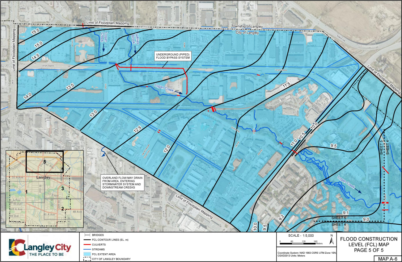
Based on new climate change models and the fall 2021 “atmospheric river” flooding event, Langley City staff have updated the data on the impacts of a 1-in-200-year flooding event.
The following maps show the new flood construction levels. This level is above which new development projects must build habitable space. Habitable space includes almost any part of a building where a human could be.

|
| Map of new flood construction levels in the western section of Nicomekl River. Select the map to enlarge. |

|
| Map of new flood construction levels in southern areas along 208th Street. Select the map to enlarge. |

|
| Map of new flood construction levels in northern areas along 208th Street. Select the map to enlarge. |

|
| Map of new flood construction levels along the Langley Bypass, Glover Road, and Duncan Way areas. Select the map to enlarge. |
|
| Map of new flood construction levels along the Langley Bypass. Select the map to enlarge. |
Langley City Council gave three readings to update our Floodplain Elevation Bylaw on Monday to update the flood construction levels. The updated bylaw also requires that a building’s mechanical, electrical, heating/cooling and safety systems are about the flood construction level unless these systems are floodproofed.
The bylaw allows underground parking, surface parking, and bike storage to be built under the flood construction level for an area.
Langley City’s Official Community Plan encourages the redevelopment of areas within the floodplain, especially around 208th Street north of 51B Avenue, by allowing ‘plexes, rowhomes, and townhomes to replace detaching housing that is below the flood construction level. The sooner redevelopment occurs in these areas, the more protection people will have from flooding, significantly reducing impacts on their life and property.
2 comments:
Thanks for this, Nathan. Can you point to where these maps can be found on the City of Langley website?
You can see it at: https://pub-langleycity.escribemeetings.com/filestream.ashx?DocumentId=16703
Post a Comment