
One of the considerations, when people choose between driving or taking transit, is the time it will take to get to their destination. Compared to today’s transit network, or business as usual (BAU), the SkyTrain extension to Langley City will cut travel times along the Fraser Highway corridor in half.
The authors of the Surrey-Langley SkyTrain business case state, “for people travelling to Surrey or Langley City centre, transit travel times become comparable, or even faster, to those made by car.”
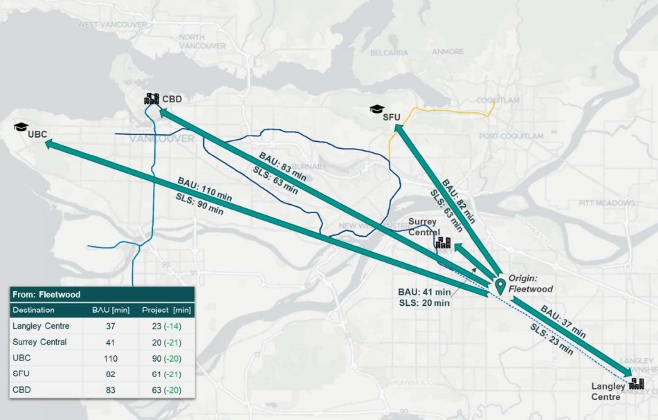
The following maps show the travel time difference between the current transit network and the transit network with the Surrey-Langley SkyTrain extension in 2050.
|
| Transit travel times from Fleetwood. Select map to enlarge. |

|
| Transit travel times from Langley Centre in 2050. Select map to enlarge. |
Travel times include walking from the station head to the platform, wait time, boarding time, and time on the train.
The project will give people throughout the region better access to jobs because of these time savings. The following map shows areas in our region where people will have to travel no more than 60 minutes by transit to access jobs by 2050.

|
| Change in transit access to jobs by 2050. Select map to enlarge. |
For more information, please read the Surrey-Langley SkyTrain business case.
No comments:
Post a Comment