Just like agricultural land in Metro Vancouver, there has been a call to create an industrial land reserve in the region. The industrial land base in Metro Vancouver has been shrinking as some municipalities have converted these lands to residential, office, and retail uses over the years. Interestingly, just like agricultural land, the South of Fraser has become the steward of industrial land.
In response to the shrinking industrial land base, Metro Vancouver created regional Industrial and “Mixed-Employment” zones to help protect this land base. The regional district has been keeping tabs on industrial land, and recently completed a detail inventory.
Metro Vancouver defines the Industrial Zone as for “heavy and light industrial activities,” and the Mixed-Employment Zone as for “industrial, commercial and other employment related uses.” It is important to note that the Mixed-Employment Zone doesn’t really protect land for industrial uses as it can be used for commercial and other employment related uses.
91% of the in-use or available industrial land inventoried in 2015 is “protected” by a regional zone. 68% is in the Industrial Zone and 23% is in the Mixed-Employment Zone.
 |
| State of protection of industrial land in Metro Vancouver. Select map to enlarge. |
Between 2010 and 2015, 870 acres of industrial land was lost to other uses. Of what remains, 45% is located in the South Fraser. The majority of vacant industrial land is also in the South of Fraser.
 |
| Land available for industrial use in Metro Vancouver. Select map to enlarge. |
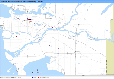
As noted, some of the industrial land base is used for offices and retail uses. This is due to both the Mixed-Employment Zone, historical reasons, municipal zoning, and inappropriate land-use.
 |
| Non-industrial uses on industrial land in Metro Vancouver. Select map to enlarge. |
Metro Vancouver’s 2015 Industrial Lands Inventory also contains detailed sub-region maps of the industrial land base and its uses. This map is for Langley.
 |
| Detailed uses of industrial land in Langley. Select map to enlarge. |
Knowing the state of the industrial land base will be critical to developing policies to further enhance its protection. For more information, please read the full technical report.

No comments:
Post a Comment