Monday, July 31, 2023

Growth Should Pay for Growth: Updating Langley City's Development Fees

Redevelopment Project

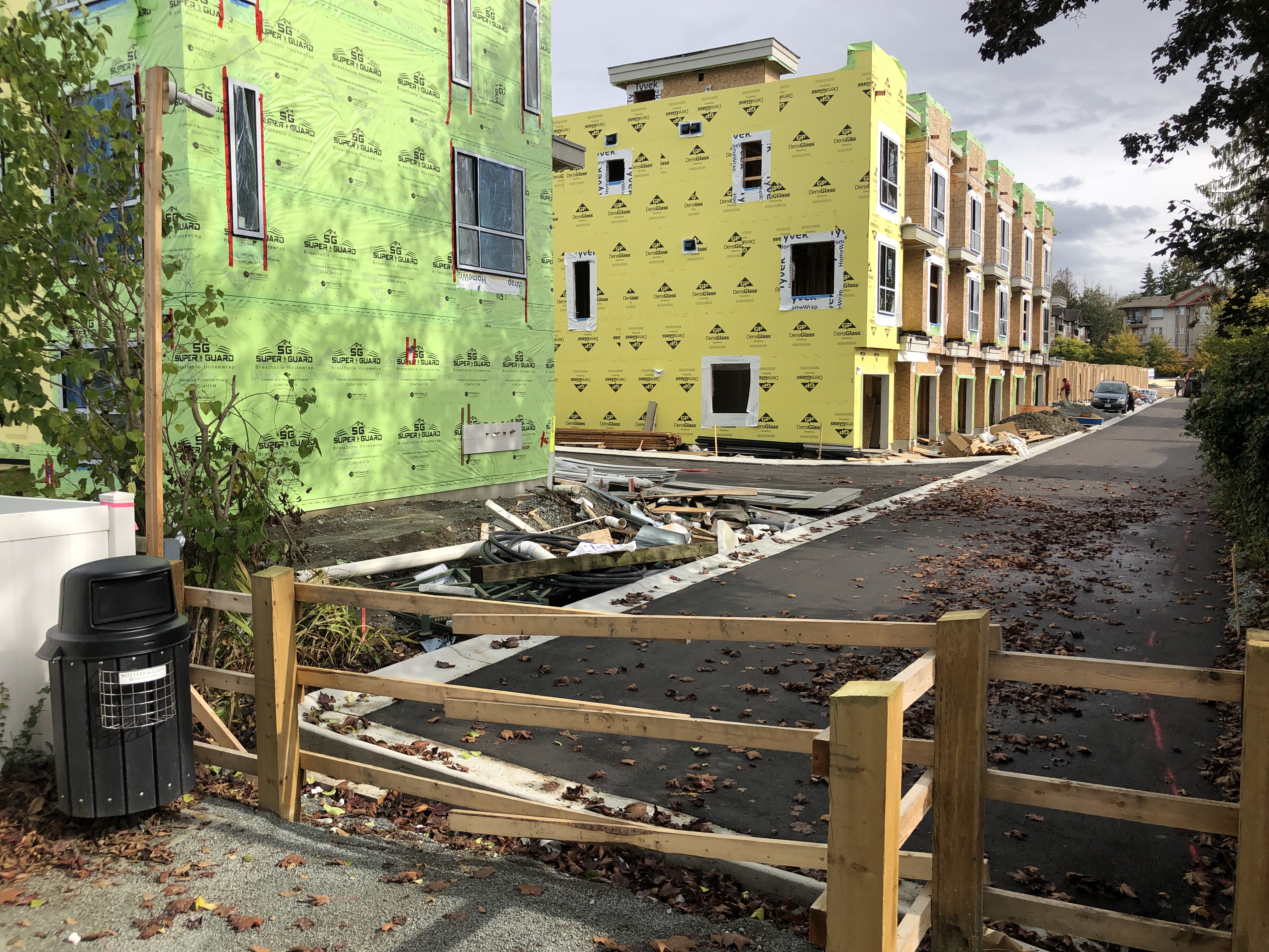
When development occurs in a community, or Langley City's case, redevelopment, we need to make sure that both infrastructure and services can accommodate that growth and that we can provide the same level of service to people and businesses in our community.

On the services side, new property tax revenue helps offset the increased cost of delivering services to a growing community. For example, more people and businesses mean we need more police officers, firefighters, bylaw officers, recreation services, library services, and park services which the City funds with property tax.

I sometimes hear folks comment that cities love development because it provides windfall property tax which, I can only guess some folks believe, gets hoarded into a Scrooge McDuck-type Money Bin. I can guarantee you this is not the case in Langley City. City Council puts every cent of property tax revenue collected from redevelopment back into the community to ensure we maintain our existing service levels even as our population grows.

The other way that municipalities can help ensure that "growth pays for growth" is through Development Cost Charges, Density Bonuses, and Community Amenity Contributions. The City charges or negotiates these fees during the redevelopment process and uses them to pay for transportation, below-market housing, parks, water, sewer, and stormwater infrastructure required due to growth. This "growth paying for growth" system does have gaps, which I've posted about in the past.

For Development Cost Charges, the City is looking at increasing the rates as follows:

Type Measure Exisiting Rate Proposed Rate
Detached per unit $18,409 $46,078
Townhouse per unit $14,503 $32,858
Apartment per unit $9,549 $21,335
Commercial ft2 GFA $6.84 $14.61
Industrial ft2 GFA $3.03 $6.07
Institutional ft2 GFA N/A $14.61

GFA = Gross Floor Area

The City has completed several plans over the last few years, which outline what projects are required to accommodate growth. These proposed rates reflect the projects in those updated plans.

The City will seek feedback from our community, the development industry and development professionals over the next few months on these proposed rates. If any adjustments are required, they will be made. Council will formally consider updating the rates in the fall. If Council approves the rates, the City must submit the updated rates and what projects they will be used for to the provincial government for approval.

Thursday, July 27, 2023

New Parks, Recreation and Culture Plan for Langley City

Since 2021, Langley City staff and consultants have been working on updating our City's Parks, Recreation and Culture Plan. The City's old plan dates back to 2013, so it was time for an update.

The City developed this plan with our community via surveys, workshops, interviews, and emails.

Our community is growing, and we've reached the point where we need to invest significantly in new parks and major facilities.

Today, it cost around $25 million per hectare to acquire land. We must create new parks in the northwestern part of our community. The good news is that we can collect development cost charges to acquire this land, so it will not impact existing taxpayers.

For another example, we need an indoor pool which would cost around $17 million in today's dollars to build. Unfortunately, we would not be able to use development cost charges.

The following is the list of key recommendations from the new plan.

Parks

  • Acquire new parkland within developing areas
  • Major Park upgrades to City Park, Buckley Park, Douglas Park, Nicomekl Floodplain, BC Hydro Corridor, Penzer Park, Uplands Dog off-leash Park, Innes Corners Plaza, Conder Park, Rotary Centennial Park, Sendall Gardens, Brydon Park

Outdoor Amenities

  • Upgrade Park amenities – older multi-sport courts, shade at playgrounds, washrooms
  • Add Park amenities – accessible washrooms, community gardens, dog offleash area, picnic facilities, tennis courts, skate park, beach volleyball courts, bike pump track, adventure play area

Trails

  • Acquire land to support trail connectivity
  • More trails, paving and infrastructure
  • Increase wayfinding signs, especially in Nicomekl Floodplain

Recreation and Culture Programs and Services

  • More fitness classes, lifestyle, and social programs for all ages, and visual and performing art classes
  • More outdoor programs, events
  • Childminding with fitness facilities
  • More partnership, more focus on equity, diversity and inclusion

Indoor Recreation Spaces

  • Upgrade and expand Timms Community Centre
  • Replace or significantly renovate/expand Douglas Recreation Centre

Aquatic Facilities

  • Plan and build a new indoor aquatic facility
  • Upgrade Al Anderson Memorial Pool to improve the energy use and recreation opportunities for the interim or long term

Culture and Multi-Use Facilities

  • Explore opportunities for a Public Private partnership in the development of a Performing Arts Centre
  • Explore opportunities for a fundraising campaign
  • Replace Sendall House with an environmental and multi-use facility
  • New multi-use community building to replace the again lawn bowling facility

The following maps show existing and proposed new park, trail, and plaza locations.

Existing and Proposed Parks and Trails, North. Select the map to enlarge.

Existing and Proposed Parks and Trails, South. Select the map to enlarge.

Legend for Maps of Existing and Proposed Parks and Trails. Select the image to enlarge.

I invite you to read the full Parks, Recreation and Culture Plan. Council endorsed this new plan at Monday night's Council meeting.

Wednesday, July 26, 2023

Langley City Neighbourhood Askes for Increased Density Due to Past Flooding

Langley City's current Official Community Plan, which Council adopted in November 2021, expanded the areas where people could have the option of building "missing middle" housing. "Missing Middle" housing is townhouses, rowhomes and 'plexes which provide lower-cost housing options for families and typically include 2-4 bedrooms.

The Official Community Plan provides new opportunities for property owners to build "missing middle" housing along the 200th Street corridor and 208th Street corridor. In addition, the City now allows "missing middle" housing in the area bound by City Park, the floodplain, and 48th Avenue, as shown in the salmon colour.

Land-use plan for a section of the Blacklock Neighbourhood. Select the map to enlarge.

Besides wanting to provide the opportunity for people to build more family housing in our community, this area in the Blacklock Neighbourhood is also in the one-in-two-hundred-year flooding area. Most of the housing in this area is below our current flood construction level, meaning many people cannot or can only purchase expensive flood insurance. Enabling "missing middle" housing can provide an option for people to get the equity out of their property and move to housing above the flood construction level. During the Official Community Plan development process, we heard most of this neighbourhood wanted this.

At last night's Council meeting, we received a petition for the homeowners in the area as shown, requesting that the City allow 3-6 storey townhouses, rowhouses, or apartments within the boundary of their area.

Petition area. Select the map to enlarge.

These people have suffered from the recent flooding and want the City to allow slightly higher density to incentivize the quick redevelopment of their properties, as they want to avoid suffering through another flooding event.

Langley City Council received the petition at Monday night's Council meeting and asked staff to prepare a report with options for Council to consider.

Tuesday, July 25, 2023

City Concerned About Regional Costs of “Piecemeal” Conversion of Rural Land to Industrial Uses Along Fraser Highway in Township. Surrey Proposes Redesignating Industrial Lands.

As I posted in May, the Township of Langley is seeking approval to convert 4.12 hectares of land at 23699 and 23737 Fraser Highway from the regionally designated Rural land use to Industrial land use from the Metro Vancouver Regional District Board.

Site of proposed regional land use change from rural to industrial. Select the map to enlarge.

In Metro Vancouver, we have an Urban Growth Boundry, which helps create a compact region that is easier and more cost-effective to services with transit, water, and sewer services while preserving rural and agricultural lands and greenspace, which helps preserve the environment.

Because the Urban Growth Boundry is so important if a municipality wants to convert rural or agricultural lands to other uses, it needs the approval, with a 2/3rd weighted vote, of the Metro Vancouver Regional District Board. Langley City, along with all other municipalities in the region, Tsawwassen First Nations, and Electoral Area “A” are part of the board.

Earlier this month, Langley City Council received a letter from the Metro Vancouver Regional District asking for our comments about this conversion of land from Rural to Industrial use. Langley City Council directed our staff to prepare a letter. At last night’s Council meeting, Langley City Council approved sending the letter that staff prepared to the Metro Vancouver Regional District Board.

You can read the full letter on Langley City’s website. I wanted to share an excerpt.

If approved this proposed redesignation will support fragmented or ‘piecemeal’ urbanization outside of the Urban Containment Boundary. This in turn could lead to the need for future sewer and water service extensions, as well as transit service expansion, in areas that do not currently have these services. This will likely result in additional long-term costs for providing and maintaining regional and municipal sewer and water services, and will redirect valuable and finite transit service funding away from areas located along the Major Transit Network and other transit service priority areas within the Urban Containment Boundary.
It is also suggested that further study be undertaken, to identify water and sewer servicing requirements and costs associated with future urbanization along the Fraser Highway corridor and outside of the Urban Containment Boundary, prior to future regional land use amendments being considered by Metro Vancouver.

On another regional matter, Langley City Council received a request from the Metro Vancouver Regional District to comment on the proposed redesignation of 10.2 hectares of Industrial land in Surrey to general urban uses. This land is located within the Urban Growth Boundary.

Council directed City staff to prepare a response letter. Industrial land is in short supply in the region, but according to the Regional District, this 10.2 hectares of land would only be accessible via a residential area which could be problematic.

Proposed regional land use change from Industrial to Rural at 11420 157A Street in Surrey. Select the map to enlarge.