Over the Canada Day long weekend, I posted a somewhat silly comment on Facebook noting that all roads called “crescent” in Langley City were not in fact crescents. A crescent is typically a road that connects a street to an avenue, or has two connections off the same road. The only “true” named crescent in Langley City is Brydon Crescent.
After I posted this comment, I started to wonder if these roads call “crescent” such as Eastleigh Crescent, Grade Crescent, Michaud Crescent, or Douglas Crescent where in fact true crescents at one point.
The provincial government has aerial photos that date back to at least 1936. Most of these photos are not online, so they need to be special ordered. I decided to special order some aerial photos from the time range between 1946 and 1953 around Langley City.
The following map shows what Downtown Langley City looked like in the early 1950s.
 |
| Aerial photo of mid-20th century Downtown Langley City with markup. Select image to enlarge. |
The green line is 200th Street, the street marked with the heart is Michaud Crescent which ran south of the Interurban passenger and freight railway. The star denotes the beginning of the Fraser Highway One-Way which is marked in yellow. The lighting bolt marks the intersection of Douglas Crescent and 208th Street. If you look closely, you can also see Eastleigh Crescent.
Looking at this photo, it is clear that these roads were never crescents.
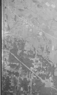
The next image shows all of Langley City in the same time period. The BC Hydro right-of-way is present in this photo. Grade Crescent, which used to be an old rail right-of-way, is also present.
 |
| Full aerial photo of mid-20th century Langley City. Select image to enlarge. |
One of the other interesting things is that 208th Street used to go around a pond which is the current site of Nicomekl Park at 208th Street and Fraser Highway. It looks like when the 208th Street Causeway was built, the pond was drained. This is something that wouldn’t be allowed today.
As far as I can tell, the term “crescent” in Langley City really means original road.
As someone who values history, I was really happy to find out that the provincial government keeps historical aerial photos of our communities.

Love exploring these two old photos and finding where the homes were located that I grew up in. One of them actually in the photo. Thank you for posting these
ReplyDelete